
United Nations Global Geodetic Centre of Excellence
UN campus, Bonn, GermanyModern society relies on satellites. Satellite information is essential for economic growth, the operation of critical infrastructure, and is a cornerstone of national defence forces. But have you ever stopped to think what satellites rely on?
Satellites are reliant on constant updates about their 'place in space' (satellite orbit information) and the Earth's 'place in space' (shape, orientation, gravity field, and coordinate reference frame). This Earth and satellite 'place in space' information are collectively known as geodetic products. Constant updates to the geodetic products are needed because the Earth and satellites are always moving.
The Earth actually moves like a spinning top. As the Earth spins, it also wobbles. Weather and natural hazards like earthquakes cause the air, water, and ice to move from place to place around the Earth which makes it wobble. Thanks to geodesy it is possible to measure these wobbles. Without updates to geodetic products, satellite applications that society takes for granted, and all the benefits they provide, would degrade or fail.
The geodetic products are created through the global geodesy supply chain which includes:
- Ground observatories and scientists who constantly observe the movement of the Earth and satellites;
- Data centres and data centre operators who quality check the data from observatories and make it available to the global geodesy analysis community; and
- Analysis centres, correlation centres, and analysts who translate the raw data into geodetic products.
It is a global geodesy supply chain because the observatories and highly qualified people need to be distributed around the world to achieve the required accuracy and reliability of the geodetic products. Figure 1 illustrates this start-to-end process of the global geodesy supply chain, from ground observations to usable products that keep satellites operational and accurate.
 Figure 1: The global geodesy supply chain.
Background
In 2020, the United Nations Committee of Experts on Global Geospatial Information Management (UN-GGIM) welcomed and supported the offer from the Federal Republic of Germany to establish and host a Global Geodetic Centre of Excellence (UN-GGCE) at the United Nations Campus in Bonn, Germany. Following the signing of the Agreement on the Operationalization of the UN-GGCE between the United Nations and the Federal Ministry of the Interior and Community (BMI), the Centre officially commenced operations. The State Secretary at the Federal Ministry of the Interior and Community, Juliane Seifert, emphasized:
"With the successful conclusion of the Agreement for the United Nations Global Geodetic Centre of Excellence Germany once more proved itself to be a reliable international partner. The Centre of Excellence is going to provide important contributions to a UN Member State agreed worldwide geodetic infrastructure. This infrastructure is the reliable long-term foundation for applications like satellite navigation, space-borne Earth observation as well as monitoring of the UN Sustainable Development Goals 2030."
Recognizing the growing need for a high quality and sustainable Global Geodetic Reference Frame (GGRF) to support good policy development and decision-making for inclusive social progress, increasing environmental sustainability and vibrant economic development, the General Assembly on 26 February 2015 adopted resolution 69/266, entitled 'A Global Geodetic Reference Frame for Sustainable Development'.
The resolution recognizes the importance of international cooperation, as no one country can do this alone, to realize the GGRF and services to underpin global navigation satellite systems technology and provide the framework for all geospatial activity, as a key enabler of geospatial data interoperability and data integration, and sustainable development. The resolution also recognizes the economic and scientific importance of and the growing demand for an accurate and stable global geodetic reference frame for the Earth that allows the interrelationship of measurements taken anywhere on the Earth and in space, combining geometric positioning and gravity field-related observations, as the basis and reference in location and height for geospatial information, which is used in many Earth science and societal applications, including sea-level and climate change monitoring, natural hazard and disaster management and a whole series of industrial applications including mining, agriculture, transport, navigation and construction, in which precise positioning introduces efficiencies.UN-GGCE's overarching goal is to assist Member States and geodetic organizations to coordinate and collaborate to sustain, enhance, access and utilise an accurate, accessible and sustainable GGRF to support science, society and global development. The objective is to support, within available resources, the implementation of General Assembly resolution 69/266 through strengthening and advancing: global geodetic cooperation and coordination; worldwide geodetic infrastructure; standards and policies; education, training and capacity development; and communication and awareness.
Connect With Us
The UN-GGCE team is composed of three personnel internationally recruited by the United Nations and six secondees from Member States, working in collaboration with partner organizations.
The personnel recruited by the United Nations are:

The personnel seconded to the UN-GGCE are:

The personnel virtually seconded to the UN-GGCE are:


As part of the UN-GGCE Partnership launched in June 2024, which recognizes the exceptional commitment and significant contributions of Member States, universities, and organizations to advancing the science of geodesy and strengthening the global geodesy supply chain, the UN-GGCE proudly acknowledges the following founding partners and partners:
Founding Partners:

Partners:


.png)


UN-GGCE Opening Ceremony
The Secretariat of the United Nations Committee of Experts on Global Geospatial Information Management (UN-GGIM), in collaboration with the Federal Government of Germany, through its Federal Ministry of the Interior and Community (BMI) and the Federal Agency of Cartography and Geodesy (BKG), hosted the Opening Ceremony of the United Nations Global Geodetic Centre of Excellence (UN-GGCE) on 29 March 2023 at the UN Campus in Bonn, Germany.
Following a series of collaborative and productive consultations over the past two years, in November 2022 an Agreement between the United Nations and the Federal Republic of Germany, which defines the modality of operationalization of the UN-GGCE, was finalized and signed. This Agreement forms the foundation for the establishment and initial operations of the UN-GGCE. The Centre's overarching goal is to assist Member States and geodetic organizations to coordinate and collaborate to sustain, enhance, access and utilize an accurate, accessible and sustainable Global Geodetic Reference Frame (GGRF) to support science, society and global development. The objective is to support within available resources the implementation of General Assembly resolution 69/266 through strengthening and advancing: global geodetic cooperation and coordination; worldwide geodetic infrastructure; standards and policies; education and capacity development; and communication and awareness, while also coordinating measures and overseeing their implementation.
Over one hundred invited guests including members of the inaugural International Advisory Committee of the UN-GGCE and the UN Subcommittee on Geodesy attended the Opening Ceremony. Guests came from every continent on Earth, except Antarctica. There was someone from each of the five regional committees of UN-GGIM, and the eight functional groups and four thematic networks that report into the UN-GGIM. The momentous occasion was graced by a number of invited dignitaries that included: Ms. Juliane Seifert, State Secretary of the Federal Ministry of the Interior and Community of Germany; Ms. Kjersti Bjǿrnstad, State Secretary of the Ministry of Local Government and Regional Development of Norway; Ambassador Peter Thomson, United Nations Secretary-General's Special Envoy for the Ocean and United Nations Global Geodesy Ambassador; Ms. Melanie Grabowy, First Deputy Mayor of Bonn; Ambassador Rainer Lassig of the UN Campus Liaison Office, Federal Foreign Office of Germany; together with Prof. Paul Becker, President of BKG and Mr. Stefan Schweinfest, Director of UN Statistics Division.
First Meeting of the International Advisory Committee
Second Consultative Meeting on the Global Geodesy Development Plan
Second Meeting of the UN-GGCE International Advisory Committee and the Fourth Plenary Meeting of the Subcommittee on Geodesy
- Concept note and provisional agenda Logistical and information note
Provisional list of participants
Summary of Decisions (Second meeting of the UN-GGCE IAC)
Summary Notes (Fourth plenary meeting of the UN-GGIM Subcommittee on Geodesy)
-
Agenda and Content, Mr. Nick Brown (Head of Office, UN-GGCE)
Role of the Subcommittee on Geodesy and UN-GGCE, Mr. Fernand Bale (Côte D'Ivoire)
From Global to Regional / National Geodetic Reference Frames: how are they connected and why are they needed?, Mr. Zuheir Altamimi (France)
UN GGIM: Arab States Geodesy working group (GRF) Progress, Mr. Abdullah Al Qahtani (Saudi Arabia)
Progress - AFREF, Mr. Aslam Parker (South Africa)
Report of UN-GGIM-AP WGI-Geodetic Reference Frame, Mr. Basara Miyahara (Japan)
UN-GGIM: Americas update, Mr. Sergio Cimbaro (Argentina) and Mr. Dan Roman (USA)
Community of interest on geodetic reference frames, Mr. Jeffrey Verbeurgt (Belgium)
NASA update, Mr. Stephen Merkowitz (USA)
FIG update on activities, Mr. Ryan Keenan (FIG)
IAG update, Mr. Richard S Gross (IAG)
Expert consultation on Strengthening the Global Geodesy Supply Chain
-
Concept note and provisional agenda
Logistical and information note
List of participants
Summary notes
-
Agenda and Content, Mr. Nick Brown (Head of Office, UN-GGCE)
Hidden risk to critical infrastructure and the economy, Mr. Nick Brown (Head of Office, UN-GGCE)
Global geodetic observation systems - global challenges to a shared resource, Ms. Nikki Markiel (USA)
Status of VLBI for the ICRF, Ms. Megan Johnson (USA)
The Global Geodesy Supply Chain importance to science and society, Mr. Richard Gross (USA)
An overview of PNT and Geodesy acivity in the UK, Mr. Mark Greaves and Mr. Mark Brammer (UK)
VLBI current status, Mr. Rüdiger Haas (Sweden)
Current status VLBI: German contribution to IAG services (BKG), Mr. Johannes Bouman (Germany)
Current state of global geodesy supply chain, Mr. Stephen Merkowitz (USA)
Current state of Global Geodesy Supply Chain from the ITRF perspective/experience, Mr. Zuheir, Altamimi (IAG)
Joint Meeting of the UN-GGIM Subcommittee on Geodesy (5th Plenary), the UN-GGCE International Advisory Committee and the UN-GGCE Steering Committee (3rd Meeting)
-
Concept Note and Detailed Agenda
Logistical Information Note
List of Participants
Summary Notes of 5th UNGGIM SCoG and 3rd UN-GGCE IAC Meeting
- UN-GGCE Update, Mr. Nicholas Brown (Head of Office, UN-GGCE)
- Building the case for investment in geodesy in the Australian Government, Ms. Martine Woolf (Geoscience Australia)
- ESA's Approach for long Term GNSS Sensor Station Hosting, Mr. Werner Enderle (ESA ESOC, Germany)
- Example Governance Structure, Ms. Elizabeth D'Anastasio (GNS Science, New Zealand)
- Examples of International Agreements, Mr. Johannes Bouman (BKG, Germany)
- Introduction to website where countries track progress against activities, Mr Hannes Frings (BKG, Germany)
- Definition of Essential Geodetic Variables, Detlef Angermann (IAG GGOS)
- Robust Global Geodesy Supply Chain, Ms. Liubov Poshyvailo-Strube (UN-GGCE)
- FIG Status Report, Mr. Ryan Keenan (FIG)
- IAG Status, Mr Richard S. Gross (IAG)
- NASA Status, Mr. Stephen Merkowitz (NASA)
- UNGGIM Arab States GRF Working Group Report, Mr. Abdullah Al-Qahtani (GEOSA, Saudi Arabia)
- UNGGIM Europe Report, Mr. Jeffrey Verbeurgt (NGI, Belgium)
- UN-GGIM Asia Pacific WG1 Report, Mr. Basara Miyahara (Japan) UN-GGIM Africa Report, Mr. Aslam Parker (South Africa)
- UN-GGIM Americas Report, Mr. Gustavo Caubarrere, Ms Sandra Bolanos (SIRGAS)
- UNOOSA Status, Ms Sharafat Gadimova (UNOOSA)
Joint Meeting of the UN-GGIM Subcommittee on Geodesy (6th Plenary), the UN-GGCE International Advisory Committee and the UN-GGCE Steering Committee (4th Meeting)

-
Concept Note and Detailed Agenda
Logistical Information Note
List of Participants
SCoG and IAC Meeting Summary
Group Photos Bonn, Germany 9-12 March 2026
-
Summary of UN-GGCE actions in the past year - Nicholas Brown (UN-GGCE, USA)
Global Geodesy Supply Chain Maturity Assessment - Liubov Poshyvailo-Stube (UN-GGCE, USA)
State of Geodesy 2026 - Nicholas Brown (UN-GGCE, USA)
International Governance of Geodesy - Laila Løvhøiden (Kartverket, Norway)
Zero Draft of Robust Global Geodesy Supply Chain - Nicholas Brown (UN-GGCE, USA)
Geodesy Capacity Development Workshops and plans for 2026 - Nicholas Brown (UN-GGCE, USA)
Stakeholder Engagement and Communications Plan 2026 - Allison Craddock (UN-GGCE, USA)
Joining Land and Sea - Evert Mulder (Singapore Land Authority, Singapore)
Joining Land and Sea - Dan Roman (National Geodetic Survey, USA)
Essential Geodetic Variables - Detlef Angermann (UN-GGCE Secondee from TUM, Germany)
Frequency Protection Working Group - Jeffrey Verbeurgt (National Geographic Institute, Belgium)
Update from NASA - Stephen Merkowitz (Space Geodesy Project Manager, USA)
UN-GGIM regional geodesy working groups update - Arab States - Sultan AlShahrani (Saudi Arabia)
UN-GGIM regional geodesy working groups update - Europe - Jeffrey Verbeurgt (Belgium)
UN-GGIM regional geodesy working groups update - Asia-Pacific - Basara Miyahara (Japan)
UN-GGIM regional geodesy working groups update - Africa - Zouheir Fatnassi (Tunisia)
UN-GGIM regional geodesy working groups update - Americas - Gustavo Caubarrere (Uruguay)
UN-GGIM regional geodesy working groups update - Americas - Dan Roman (USA)
UNOOSA ICG Update - Sharafat Gadimova (Austria)
IAG Update - Richard Gross (USA)
FIG Update - Ryan Keenan (Australia)
Capacity and Education Working Group - Daniel Roman (USA)
Strategy and Operation
-
UN-GGCE Strategy and Operating Plan v1.0 - English | Russian | French | Arabic
UN-GGCE Partnership Program
1st Joint Development Plan for Global Geodesy
Newsletters
Policy Briefs
UN-GGCE - International Workshop on Joining Land and Sea with BIG
-
Concept Note and provisional agenda
- Presentations
- Day 1
- Session 1
- Joining Land and Sea-Problem as Seen by the UN-GGIM Expert Group on Land Administration and Management (EG-LAM), Dr. Victor Khoo (Singapore)
- Taking action to address climate change and natural disasters - Perspectives from the Working Group on Marine Geospatial Information, Dr Parry Oei (Singapore)
- Session 2
- Pacific Sea Level & Geodetic Monitoring Project, Mr Andrick Lal (Fiji)
- Integrating land and sea for spatial planning in a coastal area, DR. Andri Supriatna (Indonesia)
- The Philippines Perspective, Ms. Charisma Victoria de la Cruz-Cayapan (PHILIPPINES)
- Sea Level Rise and Land Subsidence Monitoring In Indonesia, Bayu Triyogo Widyantoro (Indonesia)
- Session 3
- Height is hard, Mr. Nicholas Brown (Head of Office, UN-GGCE)
- The New Zealand Joining Land and Sea Project, Ms. Jennifer Coppola (New Zealand)
- The Indonesian Digital Elevation Model, Mr. Ibnu Sofian (Indoensia)
- Realizing a Single Vertical Reference System in Archipelago Country, Ms. Leni Sophia Heliani, Mr. Hendra Noviantara, Mr. Daffa Mumtaz (Indoensia)
- Day 2
- Session 5
- Geoscience Australia's AusBathyTopo Grids, Mr. Matt Ellis (Australia)
- How Japan COULD join land and sea data, Mr. Basara Miyahara, Mr. Koji Matsuo (Japan)
- Challenges and issue in developing tsunami model in Indonesia, Dr. Sugeng Pribadi (Indonesia)
- Session 6
- Standards Considerations for Member States, Dr. Daniel Roman (USA)
- The National Policies for The Integration of Land and Sea: A Case of Indonesia, Mr. Mohamad Arief Syafi'i (Indonesia)
- The OGC Community Connecting Land and Sea Federated MSDI Pilots and ISO 19152 LADMs, Mr. Trevor Taylor & Mr. Chris Body OGC (Australia)
- Joining Land and Sea: Implications under a Law of the Sea Perspective, Ms. Ilaria Tani (Italy)
- Session 7
- Australian geoid models, Anna Riddell (Australia)
- Geodetic Infrastructure and Procedures for Vertical Land Motion & Sea Level Rise monitoring, Mr. Alex Lapadat (Netherlands)
- The Indonesian Geoid Model Development, Ms. Arisauna Pahlevi, Mr. Widy Putra, Mr. Bagas Triarahmadhana, Ms. Agustina Syafarianty, Mr. Raa Ina S. Muntaha, Mr. Dudy D. Wijaya, Mr. Brian Bramanto (Indoensia)
- Sea Level Model Development - For Hydrographic Surveys in Japan, Mr. MASANAO SUMIYOSHI (Japan)
- Development of Indonesian Tide Model, Dr.rer.nat. Wiwin Windupranata (Indoensia)
- Session 8
- Joining Land and Sea using the Global Navigation Satellite System (GNSS), Dr Lujia FENG (Singapore)
- Gathering and using data for coastal flood models - datums, models and resolution, Dr.Ooi SK (Singapore)
- Geodetic Infrastructure and Procedures for Vertical Land Motion & Sea Level Rise monitoring, Mr. Alex Lapadat (Netherlands)
- AHN_h.gif, Mr. Alex Lapadat (Netherlands)
- TUD Maps: caroline id Jakarta.mov, Mr. Alex Lapadat (Netherlands)
- Day 3
Logistical Information Note
List of Participants
Summary Notes and Decisions
Geodesy Capacity Development Workshop for Europe on Transitioning to a Modern Geospatial Reference System
-
Concept Note
Logistical Information Note
Detailed Agenda - CDW Europe
List of Participants
Group Photo Bonn, Germany 17-Feb-2025
-
1_2_1 - The importance of GRS
1_2_2 - Introduction to GRS Infrastructure
1_2_3 - Aligning national geodetic datums to ITRF
1_3_1 - ETRS89 - Introduction - Realization - Limitations
1_3_3 - Introducing regional collaboration in geodesy
2_1_2 - What is a geodetic adjustment
2_2_1 - How to undertake a national geodetic adjustment
2_3_1 - Introduction to standardisation in geodesy
2_3_2 - Tools for standardisation
2_3_3 - Data registers and data sharing policies
3_1_1 - Development of transformation parameters
3_1_2 - Example - Creating transformation parameters
3_2_1 - Height Datums and Geoid Models
3_2_2 - Steps in Geoid Modelling
3_3_1 - Identifying CapDev needs & CountryCases
3_3_2 - International Geodesy initiatives and partners
3_4_1 - UN-GGCE Update
4_1_1 - Communications
4_2_1 - WHAT Developing business cases & Group Activity
4_3_1 - Governance
5_2_1 - Forward looking Future Directions for Geodesy
5_2_2 - HPC&AI
UN-GGCE Geodesy Capacity Development Workshop for Africa on Transitioning to a Modern Geospatial Reference System
- Documentation
- Concept Note EN | FR
- Detailed Agenda EN | FR
- Logistical and Information note for Nairobi, Kenya
- List of Participants
- Videos Playlist on Youtube Group Photo Nairobi, Kenya 19-May-2025
- Presentations
- Africa_CDW_Agenda EN
- 1_2_1 - The Importance of a GRS EN | FR | Video
- 1_2_3 - Introduction to GRS Infrastructure EN | FR | Video
- 1_2_2 - UN-GGCE Update EN | FR
- 1_2_4 - Aligning National Geodetic Datums to ITRF EN | FR | Video
- Geodesy Factbook (AUS) EN | FR
- 1_3_1 - Regional Collaboration in Geodesy EN | FR
- 1_3_2 - History of the African Reference Frame EN | Video
- 1_4_1 - Options for Aligning Datums with ITRF EN | Video
- Geodesy Factbook (Blank Draft) EN | FR
- 2_2_1 - National Geodetic Adjustments EN | FR | Video
- 2_3_1 - Introduction to Standardisation in Geodesy EN | FR | Video
- 3_1_1 - Development of Transformation Parameters EN | FR | Video
- 3_1_2 - Example: Creating Transformation Parameters EN | FR | Video
- 3_2_1 - Height Datums and Geoid Models EN | FR | Video
- 3_2_2 - Joining Land and Sea EN | FR | Video
- 3_3_1 - Identifying Capacity Development Needs & Country Cases EN | FR | Video
- 3_3_2 - International Geodesy Initiatives and Partners EN | FR | Video
- 3_4_1 - GGOS Africa (Ms Aletha de Witt & Mr Jack Radcliffe) | Video
- 3_4_2 - Lantmäteriet's Role in Africa (Mr Christopher Byren) | Video
- 3_4_3 - Alumni of the Workshop
- 4_1_1 - Communications EN | FR | Video
- 4_2_1 - Developing Business Cases (Mr Albert Momo & Mr Ryan Keenan) EN | FR | Video
- Geodesy Country Reports (18 Countries) | Video
-
Geodesy Partner Reports: Video
RCMRD Report (PDF)
UN Habitat Report (PDF)
AFRIGIST Report (PDF) - 4_3_1 - Governance EN | FR | Video
- 5_2_1 - Future Directions for Geodesy EN | FR
- Roadmap to Modernise a Country GRS EN | FR
- How to Process a GNSS Network Solution with AUSPOS EN | FR
UN-GGCE Geodesy Capacity Development Workshop for Asia-Pacific on Transitioning to a Modern Geospatial Reference System

- Documentation
- Concept Note
- Logistical and Information Note
- Detailed Agenda_Asia_Pacific
- List of Participants
- Presentations
- 1_2_1 - The importance of a GRS | Video
- 1_2_2 - UN-GGCE update | Video
- 1_2_3 - Introduction to GRS infrastructure | Video
- 1_2_4 - Aligning national geodetic datums with the ITRF | Video
- 1_3_1 - Introducing regional collaboration in geodesy | Video
- 1_3_3 - UN-GGIM-AP Geodetic Working Group | Video
- 1_4_1 - Options to align their datums with ITRF (A-PAC) | Video
- 1_4_2 - National geodetic adjustments | Video
- 2_2_1 - Introduction to standardisation in geodesy | Video
- 2_3_1 - Development of transformation parameters | Video
- 2_3_2 - Example - Creating transformation parameters | Video
- 2_4_1 - Identifying capacity development needs | Video
- 2_4_2 - International geodesy initiatives and partners | Video
- 3_1_1 - Height datums and geoid models | Video
- 3_2_1 - Joining land and sea - not presented | Video
- 3_3_1 - Realization of Chart Datum and Its Connection to the Mainland Height System | Video
- 3_3_2 - Business Case: A new geodetic datum for PNG | Video
- 3_3_3 - Alumni of the Network
- 3_4_1 - UniSQ Pacific Project | Video
- 4_1_1 - Communicating geodesy | Video
- 4_2_1 - Developing business cases | Video
- 4_3_1 - Governance | Video
- 4_3_2 -Pacific Geospatial & Surveying Council | Video
- Roadmap to modernise a country GRS | Video Part 1 | Video Part 2
- GDA2020 Update Process Guidelines v6.3
- Partner Countries' Presentations (A-PAC) | Video | Video: Group Activity: Working on your Roadmap
- Geodesy Factbook (AUS Example)
- Geodesy Factbook (Blank Draft)
- GRS diagram
UN-GGCE Geodesy Capacity Development Workshop for Americas on Transitioning to a Modern Geospatial Reference System

- Documentation
- Concept Note EN | ES | PT
- Logistical Note EN | ES
- Detailed Agenda Americas EN | ES | PT
- List of Participants
- Videos Playlist on Youtube
- Presentations
- Video: Opening Remarks, Introduction and Overview
- 1_2_2 - The Importance of a GRS EN | ES | PT| Video
- 1_2_3 - UN-GGCE Update EN | ES | PT| Video
- 1_3_1 - Introduction to GRS Infrastructure EN | ES | PT| Video
- 1_3_2 - Aligning National Geodetic Datums with the ITRF EN | ES | PT| Video
- 1_4_1 - Introducing Regional Collaboration in Geodesy EN | ES | PT| Video
- 1_4_2 - Options for Asia-Pacific Countries to Align Datums with ITRF EN | ES | PT| Video
- 2_2_1 - National Geodetic Adjustments EN | ES | PT| Video
- 2_3_1 - Introduction to Standardisation in Geodesy EN | ES | PT| Video
- 3_1_1 - Development of Transformation Parameters EN | ES | PT| Video
- 3_1_2 - Creating Transformation Parameters EN | ES | PT| Video
- 3_2_1 - Height Datums and Geoid Models EN | ES | PT| Video
- 3_3_1 - Identifying Capacity Development Needs EN | ES | PT| Video
- 3_3_2 - International Geodesy Initiatives and Partners EN | ES | PT| Video
- 3_4_1 - Instituto Panamericano de Geografia e Historia ES | PAIGH EN| Video
- 3_4_2 - Part 1 CARIGEO | Video
- Part 2 SIRGAS | Video 3_4_2-Part 3 Jamaica -Canada-TAP| Part 2 & Part 3 Video
- 4_1_1 - Communicating Geodesy EN | ES | PT| Video
- 4_2_1 - Developing Business Cases EN | ES | PT| Video
- Geodesy country reports (19 Countries) | Video
- 5_1_1 - Governance EN | ES | PT| Video
- 5_1_2 - Joining Land and Sea EN | ES | PT| Video
- Geodesy Factbook (Blank Draft) EN | ES | PT| Video
- Geodesy Factbook (AUS Example) | Video
- Roadmap to Modernise a Country GRS EN | ES | PT| Video
Roadmap to Modernise a Country's Geospatial Reference System
Overview
The Roadmap provides a guidance on how to modernise and implement a country's GRS to ensure that all geospatial data whether from maps, satellite imagery, or GNSS enabled technologies is accurately aligned to a unified, nationally consistent way. This foundation supports precise positioning, underpins smart infrastructure, enhances resilience to climate change and natural disasters, and facilitates integration with international geodetic frameworks. The Roadmap also defines governance structures, guides institutional responsibilities, and prioritizes investments in infrastructure and capacity development.
The Roadmap is organised as a sequence of steps to guide countries from understanding their current geodetic environment through to implementation, adoption, and long-term operation of a modern Geospatial Reference System (GRS).
Reference material
Roadmap steps
- 1. Understand the Current Geospatial Reference System and Stakeholder Needs
- 2. Communicate Why an Update is Needed
- 3. Establish Good Governance
- 4. Develop Business Cases
- 5. Create a Project Plan
- 6-8. Establish a GNSS Network, Collect and Process GNSS Data
- 9. Perform National Geodetic Adjustment
- 10. Develop 7-Parameter Transformation
- 11. Develop Plate Motion, Distortion or Deformation Model
- 12. Develop a Physical Height Datum
- 13. Update Legal and Policy Documents

1. Understand the Current Geospatial Reference System and Stakeholder Needs
Part of the Roadmap to Modernise a Country's Geospatial Reference System.
Understanding the current Geospatial Reference System and stakeholder needs is essential before making any changes, as updates can be costly, time-consuming, and disruptive if not clearly required. Changes that are unnecessary may waste resources and impact systems that already meet user needs. Updated components must be justified by stakeholder demand and meet accuracy requirements now and into the future.
Action 1.1: Document the current Geospatial Reference System in the form of a Geodesy Factsheet for your country (Appendix A).
Action 1.2: Create a diagram describing your country's GRS (Figure 1).
Action 1.3: Identify and understand the needs of stakeholders.
Action 1.4: Summarize stakeholder needs and decide which elements of the GRS need updating.
Action 1.5: Classify stakeholders using a matrix of their level of interest and level of influence (Figure 2).

Reference material
2. Communicate Why an Update is Needed
Communicating the need to update the Geospatial Reference System
Part of the Roadmap to Modernise a Country's Geospatial Reference System.
Related resources
- Communications presentation (UN-GGCE Capacity Development Workshop)
- National communication materials: Australia | New Zealand
- Roadmap Appendix B: Communications Plan (Example)
3. Establish Good Governance
Establishing effective governance arrangements
Part of the Roadmap to Modernise a Country's Geospatial Reference System.
Related resources
4. Develop Business Cases
Justifying investment in a modern Geospatial Reference System
Part of the Roadmap to Modernise a Country's Geospatial Reference System.
A business case for updating the country geospatial reference system should justify the investment by clearly outlining the benefits, costs, and expected outcomes. It provides decision-makers with evidence to support funding and prioritization, aligning the project with broader strategic goals of the government.
Action 4.1: Develop a business case/s which provide a clear and concise argument that demonstrates why an investment in the GRS is worthwhile.
Guidance
- The business cases should be written in a way policy makers can understand and should explain why change is needed, resources required, potential value or gains for the country and risks associated with the project.
- UN-IGIF Appendix 3.8 provides a draft structure (and example) of a business case covering five key perspectives.
- Business Case Development presentation (UN-GGCE)
- UN-IGIF Sustainable Funding Guide presentation
Examples and further reading
- Australia example: Business Case - PNT in Government
- Positioning Australia: industry case studies
- Positioning Australia: economic benefits study
- EUSPA Market Report 2024
- Roadmap Appendix C: Airborne Gravity Business Case Example
5. Create a Project Plan
Planning the implementation of a modern Geospatial Reference System
Part of the Roadmap to Modernise a Country's Geospatial Reference System.
Developing a project plan is essential to define the scope, timeline, resources, and responsibilities for updating a geospatial reference system. It provides a structured roadmap that guides the project team, helping to manage risks and stay on schedule. A clear plan also facilitates communication and coordination among stakeholders, ensuring that objectives are met efficiently and effectively.
Action 5.1: Develop a project plan for the elements of the GRS you will be updating which includes scope, timeline, resources, and budget required for the GRS development.
Guidance
- UN-IGIF Appendix 1.4 provides a template of a country-level action plan.
- UN-IGIF Appendices 1.5 and 1.6 contain tools to monitor and evaluate the plan and establish success indicators.
6-8. Establish and Operate a GNSS Network
Design, installation, data collection and processing
Part of the Roadmap to Modernise a Country's Geospatial Reference System.
6. Establish a GNSS Network
Action 6.1: Design a GNSS network.
Action 6.2: Install a GNSS network.
Guidance
- Stations should be located on stable ground with minimal subsidence or surface heave.
- Aim for relatively consistent spacing between GNSS sites and include sites on major islands and key locations.
- Consider multi-GNSS capability (GPS, GLONASS, Galileo, BeiDou).
- Ensure consistent recording of GNSS data (e.g., RINEX format, IGS standards).
- Standardize sampling rates (e.g., 1 Hz for real-time applications, 30s for long-term monitoring).
- Maintain metadata records (station location, hardware, software, environmental conditions).
- IGS Guidelines for Continuously Operating Reference Stations
- ICSM Guideline for Installation and Documentation of Survey Control Marks
7. Collect GNSS Data
Action 7.1: Collect and archive GNSS CORS data.
Action 7.2: Collect and archive GNSS campaign data.
8. Process GNSS Data
Action 8.1: Process GNSS CORS data.
Action 8.2: Process GNSS campaign data.
Related resources
9. Perform National Geodetic Adjustment
Performing a unified and consistent national adjustment
Part of the Roadmap to Modernise a Country's Geospatial Reference System.
Related resources
- Australia example: AFN constraint reference
- Australian Geospatial Reference System Compendium (Chapter 9)
- DynAdjust - open-source adjustment software
- Aligning national datums to ITRF (UN-GGCE)
- What is a geodetic adjustment? (UN-GGCE)
- How to undertake a national adjustment (UN-GGCE)
- Example publication: Australian datum development (journal article)
10. Develop 7-Parameter Transformation
Enabling interoperability between legacy and modern reference systems
Part of the Roadmap to Modernise a Country's Geospatial Reference System.
Related resources
11. Develop Plate Motion, Distortion or Deformation Model
Part of the Roadmap to Modernise a Country's Geospatial Reference System.
Related resources
12. Develop a Physical Height Datum
Part of the Roadmap to Modernise a Country's Geospatial Reference System.
Related resources
13. Update Legal and Policy Documents
Part of the Roadmap to Modernise a Country's Geospatial Reference System.
Action 13.1: Work with the project planning team to address the following questions:
- Does your country have legislation, regulations or policies that must be updated to recognise the new datums?
- How will changes impact land titles, cadastral records and boundary definitions?
- Have key stakeholder groups been engaged sufficiently?
- Have you provided guidance on how stakeholders can transition to or use the new datum?
- Will the change cause discrepancies in border definitions by coordinating with adjacent countries?
Appendix A: Country Geodesy Factbooks
The Multilateral Memorandum of Understanding (MMOU) on Strengthening the Global Geodesy Supply Chain became operative on 10 March 2025.
The MMOU is a shared recognition by Member State government departments and agencies, private sector companies, organizations, associations, and academic institutions, together with the United Nations Global Geodetic Centre of Excellence (UN-GGCE), that action is required to make the foundations of positioning, navigation, and timing services robust.
The purpose of the MMOU is to help you.
The MMOU allows you to demonstrate to leaders and policymakers that the global geodesy supply chain is dependent on international cooperation and collaboration, and there is an international 'coalition of the willing' (the Participants of the MMOU) who consider this to be a problem we must work on together. The MMOU does not require Participants to make financial commitments.
You can join the MMOU as a Participant at any time.
If you wish to join, please send a letter to un-ggce@un.org on official letterhead from your government agency or organization.
Download the MMOU:
Geodesy & Geospatial Opportunities
As part of the 1st Joint Development Plan on Global Geodesy, this page announces vacancies at the UN Global Geodetic Centre of Excellence (UN‑GGCE) and highlights opportunities supported by partners in geodesy and related geospatial fields.
These listings support international cooperation to strengthen skills, advance research, and grow a diverse and skilled global geodetic workforce.
Current Opportunities at UN-GGCE
-
INTERN - E-Learning Content Development & Digital Learning Support
Deadline: 16 May 2026
View details and apply -
INTERN - Geodesy & Geospatial Research Support
Deadline: 12 May 2026
View details and apply -
INTERN - Digital Design, Data Visualization & Geospatial Communications
Deadline: 12 May 2026
View details and apply
IAG & UN-GGCE Joint Job Platform
For geodesy-related, non-commercial vacancies in academia, research, and government, view or submit opportunities via the IAG & UN-GGCE Joint Job Platform:
https://geodesy.science/jobs
How it works:
- Submitted via Post a New Job
- Reviewed and approved by the IAG Secretariat
- Published immediately and shared via a weekly newsletter
Other Institutional Portals
-
Land Information New Zealand (LINZ)
Geospatial science, surveying, and land management positions.
More information -
African Regional Institute for Geospatial Information Science and Technology (AFRIGIST)
Education, research, and training in geodesy, GIS, photogrammetry, and remote sensing.
More information
Share an Opportunity: If you are a partner and would like to publish an opportunity that does not fit the IAG Joint Job Platform, please send details to un-ggce@un.org.
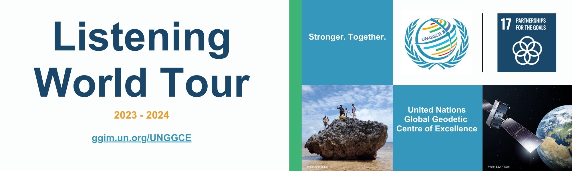
The vision of the United Nations Global Geodetic Centre of Excellence (UN-GGCE) is one where all countries have strong political support for geodesy which enables them to - together - accelerate the achievements of the Sustainable Development Goals and derive social, environmental and economic benefits.
One of the first things we are doing is our "Listening World Tour" where we want to hear from you. We are organizing virtual meetings over the next few months with Member States in the Americas, Africa, Arab States, Asia-Pacific and Europe to hear what you need. We will also be reaching out to scientific organizations like the International Association of Geodesy (IAG), International Federation of Surveyors (FIG), International Hydrographic Organization (IHO) and - International Organization for Standardization TC/211 (ISO).
Our objective at the UN-GGCE is to work with Member States and geodetic organizations to strengthen our collective impact to:
- Enhance investment in the global geodesy supply chain.
- Improve coordination and collaboration amongst Member States and geodetic organizations.
- Share geodetic data and improve standards, on a voluntary basis, to contribute to the global reference frame and regional densifications.
- Provide greater technical assistance, especially for capacity development in geodesy for developing countries.
- Make geodesy and its benefits more visible and understandable to society.
The Listening World Tour will take place in these regions and organizations the next months:
"Listening Tour" UN-GGCE International Advisory Committee
Documentation (forthcoming)
If you want to be part of these events, please keep a look out on email and social media. Alternatively, please send the UN-GGCE a message and we will let you know which session would best suit you and your organization.
Contact information:
Ms. Sarah KowalUnited Nations Global Geodetic Centre of Excellence
Email: un-ggce@un.org