Fifth High Level Forum on United Nations Global Geospatial Information Management
Mexico City, Mexico- 28 - 30 NOVEMBER 2017
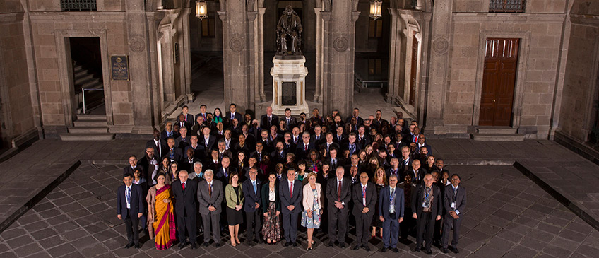
The 5th High Level Forum on Global Geospatial Information Management, with the theme "Implementing the Sustainable Development Goals: The Role of Geospatial Technology and Innovation", was organized by United Nations Statistics Division as the Secretariat for UN-GGIM in collaboration with the Government of Mexico through the National Institute of Statistics and Geography (INEGI), supported by Geospatial Media and Communications in Mexico City. This was the fifth edition of UN-GGIM's High Level Forum and had substantive support from each of the five Regional Committees of United Nations Global Geospatial Information Management (UN-GGIM: Africa, UN-GGIM: Americas, UN-GGIM: Arab States, UN-GGIM: Asia and the Pacific, and UN-GGIM: Europe), as well as the UN-GGIM networks, namely Private Sector Network, Academic Network and Geospatial Societies.
There were over 300 participants from 73 countries including from least developed countries, small island developing states and landlocked developing countries. These participants came from all five regions within UN-GGIM regional architecture, as well as from governments, inter-governmental and international organizations, academia and the private sector. On the first day, the ministerial segment of the Forum heard a keynote presentation from Mexico and six Ministerial statements. The ministerial segment highlighted people's expectations of the 2030 Agenda, the duty and the role of geospatial information, innovation and technologies to meet these expectations. The keynote presentation at the Opening Ceremony showcased geospatial technology and innovation as the critical enabler in providing open, interoperable, and standards-based systems that extend capabilities for data analysis, collaboration, user engagement, and communication to strengthen national statistical and information systems to securely store, access, analyze, and share their data in a safe and scalable environment, making it usable to the wider SDGs community.
The Forum aims to substantively improve and strengthen the national geospatial information management capacities of countries, particularly developing countries, towards implementing the 2030 Agenda and evidence-based policy and decision making.
With over sixty presentations, the Forum held in-depth dialogue on the critical role of geospatial technology, innovation, and highlight the importance of public-private partnerships for the enhancement of geospatial knowledge and services to attain the SDGs. The Forum concluded with the adoption of the Mexico City Declaration on Global Geospatial Information Management. This affirmed the significant contribution of geospatial technologies, processes and innovation in the implementation of the 2030 Agenda for Sustainable Development.
On December 1, the UN-GGIM Bureau had its annual meeting, considered and reviewed progress of various work programmes under the Committee of Experts since the seventh session in August 2017. The Bureau interacted with the World Bank on the development of an overarching geospatial framework that can be referenced by Member States when strengthening their national geospatial information management and systems. The meeting also discussed the First United Nations World Geospatial Information Congress that will be convened in collaboration with the Government of China from 27 - 29 November 2018 in Deqing, China.
There were two side events. On November 26-27, the Subcommittee on Geodesy had its inaugural meeting attended by 15 Member States, and discussed its plans and activities related to education and capacity development, communications and outreach, and governance. The Subcommittee selected Australia and Russia as its co-Chairs. On November 27, a side event on "Using satellite imagery in the SDGs: the case of 6.6.1" was convened in collaboration with UN Environment, INEGI Mexico and other partners. The event interacted on good national practices, global developments and current methodologies in the use of existing satellite data to improve national monitoring of water related ecosystems.
Member States and geospatial information management stakeholders took advantage of this unique opportunity to exchange knowledge, practices and experiences. In meeting with one another peer-to-peer interactions on strategies, approaches and methods that support sub-national, national and regional initiatives towards increasing availability, accessibility and application of high-quality, reliable and timely geospatial information. This builds towards geospatial technology and innovation for the 2030 Agenda for Sustainable Development.
Documentation for the Fifth High Level Forum
Outcome of the Fifth High Level Forum on Global Geospatial Information Management
Opening ceremony
Opening Ceremony
- Moderator: Mr. Rolando Ocampo, INEGI, Mexico
- Welcome Remarks
- Mr. Stefan Schweinfest, Director, United Nations Statistics Division
- Dr. Julio Santaella, President, INEGI, Mexico
- Mr. Sanjay Kumar, CEO, Geospatial Media and Communications, India>
- Dr. Li Pengde, Co-Chair, UN-GGIM, China
- Ms. Alicia Bárcena Ibarra, Executive Secretary, ECLAC
- Opening Statement: H.E. Under-Secretary Rodolfo Lacy Tamayo, Ministry of Planning and Environmental Policy, Mexico
- Opening Keynote Address: Mr. Jack Dangermond, Esri, USA
Ministerial segment
Ministerial Segment
- Moderator: Mr. Tim Trainor, Co-Chair, UN-GGIM, USA
- Welcome Remarks: Mr. Stefan Schweinfest, Director, United Nations Statistics Division
- Keynote Ministerial Statement: Mr. Julio Santaella, President of INEGI, Mexico
- Statement by Ministers
- H.E. Minister Romauld Ferreira, Minister of Environment & Housing, the Bahamas
- H.E. Vice Governor Sun Jingmiao, Vice Governor, the Government of Zhejiang Province, China
- H.E. Secretary-General June Soomer, Association of Caribbean States
- H.E. Under-Secretary Javier García Bejos, Planning Assessment and Regional Development, SEDESOL, Mexico
- H.E. Chief Director Froylan Rolando Hernandez Lara, National Agrarian Registry, Mexico
Session 1
Session 1: Implementing the SDGs: The relevance of geography and reliable, timely, accessible and disaggregated data
- Moderator: Ms. Dorine Burmanje, Co-Chair, UN-GGIM, the Netherlands
- Keynote Presentation: Implementing the SDGS: Territory matters
- Ms. Alicia Bárcena Ibarra, Economic Commission for Latin America and the Caribbean
- Panel Discussion
- Implementing the SDGs: The relevance of geography and "where"
- Ms. Paloma Merodio, INEGI, Mexico
- Arctic Spatial Data Infrastruccture Enabling Access to Arctic Location Based Informationn
- Mr. Bengt Kjellson, Lantmäteriet, Sweden
- Implementing the SDGs: The relevance of geography and "Where"
- Dr. Bandar Al-Muslmani, General Commission for Survey, Saudi Arabia
- Implementing the SDGs in Burkina Faso: The Relevance of Geoggraphy and "Where"
- Mr. Abdoulaye Belem, Geographic Institute, Burkina Faso
- Moderator: Mr. Stefan Schweinfest, Director, United Nations Statistics Division
- Keynote Presentation: Intelligence for decision making on the Natural Capital of Mexico
- Professor José Sarukhán, Nacional Conabio, Mexico
- Panel Discussion
- National SDG Data Hubs: Statistical Integration and Geographic Disaggregation
- Mr. Enrique Ordaz, INEGI, Mexico
- Ireland's United Nations Sustainable Development Goals Data Hub
- Ms. Lorraine McNerney, Ordnance Survey Ireland, Ireland
- National SDG Data Hubs: Statistical Integration and Geographic disaggregation (Philippines)
- Mr. Edwin Aragon, Philippines Statistics Authority, Philippines
- National SDG Data Hubs: Statistical Integration and Geographic disaggregation
- Ms. Amal Jaber, Palestine Central Bureau of Statistics, Palestine
Session 2
Session 2: Geospatial knowledge platforms: Empowering the SDGs through geographic tools and services
- Moderator: Mr. Gary Johnston, Geodesy and Seismic Monitoring, Geoscience Australia, Australia
- Keynote Presentation: What is the role of Geospatial Knowledge Platforms in delivering SDGs?
- Mr. Nigel Clifford, Ordnance Survey, United Kingdom
- Panel Discussion
- Remote Sensing Data to Serve the SDGs
- Mr. Johannes Riegl Jr., Riegl USA, USA
- Geospatial knowledge platforms: How do we deliver data fro the SDGs
- Mr. Lawrence Modise, Statistics South Africa, South Africa
- Mapping a sustainable world Geospatial knowledge platforms: Empowering the SDGs through maps
- Prof. Menno-Jan Kraak, International Cartographic Association, University of Twente, the Netherlands
- Brazil Experience in SDG data integration and dissemination
- Mr. Wadih Joao Scandar Neto, Geosciences, IBGE, Brazil
- Moderator: Prof Chen Jun, ISPRS, China
- Keynote Presentation: Open Data Neutral Platform Transformative Impact
- Ms. Anne Hale Miglarese, Radiant Earth, USA
- Panel Discussion
- Geospatial technologies, platform and services: Reaching the developing countries
- Mr. Fernand Guy Isseri, National Mapping Institute, Cameroon
- Opportunities and Obstacles for Enabling the Use of Geospatial Applications
- Ms. Krystal Wilson, Secure World Foundation, USA
- The Challenges faced by Cambodia Regarding Technologies, Platform and Services
- Mr. Darith Hor, Statistics and Provincial Planning, Ministry of Planning, Cambodia
- Geospatial Technologies, Platforms and Services at a subnational level
- Mr. Rogelio Campos Cornejo, Institute of Statistical and Geographic Information, Jalisco, Mexico
- Geospatial Technologies, Platforms, and Services Reching the Develping Countries
- Air Commodore Ahmed bin Saif Al-Ba'di, National Survey Authority, Sultanate of Oman
Session 3
Session 3: Implementing the SDGs: The role of geospatial research and innovation
- Moderator: Ms. Carol Agius, UN-GGIM: Europe Administrator, EuroGeographics, Belgium
- Keynote Presentation: Geospatial Research & Innovations
- Mr. Rajesh Alla, IIC Technologies Limited, India
- Panel Discussion
- Implementing the SDG's: The role of geospatial research and innovation
- Mr. Manuel Suárez, Institute of Geography, National University of Mexico
- The Role of Proximity, Water Quality, and Tradition in Selection of Drinking Water Source
- Dr. Charlotte Smith, University of California, Berkeley-School of Public Health, USA
- Implementing the SDGs: The role of geospatial research and innovation
- Mr. Max Lobo, National Geographic Institute, Costa Rica
- Scaling up geospatial research and innovation to meet the needs of the SDGs The role of satellite Earth Observations
- Mr. Marc Paganini, European Space Agency, Italy
- Common geographies for dissemination of SDG Indicators
- Mr. Janusz Dygaszewicz, Central Statistical Office, Poland
- Moderator: Dr. Hansjoerg Kutterer, Federal Agency for Cartography and Geodesy, Germany
- Keynote Presentation: Think Global, Act Local? Research Infrastructures & SDG measurement
- Mr. Ed Parsons, Geospatial Technologist, Google, United Kingdom
- Panel Discussion
- How is Geospatial Research is Contributing to the measurement of SDG indicators? A Caribbean Perspective
- Dr. Bheshem Ramlal, The University of West Indies, Trinidad and Tobago
- AmeriGEOSS Regional Initiative A community platform to support understanding and decision-making
- Mr. Ivan DeLoatch, Federal Geographic Data Committee, USA
- Geospatial Data for Advancing Health-related SDGs
- Dr. Ramesh Krishnamurthy, Health Systems and Innovation Cluster, WHO
- How can geospatial research contributing to the measurement of SDG indicators?
- Mr. Greg Scott, UN-GGIM Secretariat, United Nations Statistics Division
Session 4
Session 4: Integrated information systems: A national priority for implementing the SDGs
- Moderator: Mr. John Kedar, Director, International Engagement, Ordnance Survey, United Kingdom
- Keynote Presentation: Integrated Information Systems A National Priority for Implementing the SDGs
- Mr. Andrew Wild, Planet, USA
- Panel Discussion
- Bridging the Geospatial Digital Divide: World Bank-UN-GGIM Partnership
- Ms. Kathrine Kelm, World Bank, USA
- Mr. Tim Trainor, Census Bureau, USA
- Strengthening Geospatial Information Management in Indonesia
- Dr. Ir. Hasanuddin Zainal Abidin, Geospatial Information Agency, Indonesia
- Strengthening geospatial information management and the global data ecosystem
- Ms. Dorine Burmanje, Cadastre, Land Registry and Mapping Agency, the Netherlands)
- Geospatial Innovations for Smart Cities: Managing Solar Energy
- Mr. Marco Antonio Pérez, DECSEF Systems Enterprise, Mexico
- Moderator: Mr. Alvaro Monett, Regional Expert on Geospatial Information Management, ECLAC
- Keynote Presentation: Approaches to the integration of statistical and geospatial information for the SDGs: Global and National cases
- Mr. Rolando Ocampo, INEGI, Mexico
- Panel Discussion
- Meeting the geospatial infrastructure needs for national implementations of the SDGs
- Ms. Macarena Perez, Ministry of National Assets, Chile
- Ms. Bresilda Gervacio, Department of Environment and Natural Resources, Philippines
- Geospatial Infrastructure for National SDG Implementation
- Mr. Steven Ramage, Group on Earth Observations, Switzerland
- The Open Ecosystem; Open Standards, Open/Proprietary Technologies and Open Data
- Mr. Trevor Taylor, Open Geospatial Consortium, Canada
- Meeting the geospatial infrastructure needs for national implementations of the SDGs
- Mr. Sergio Cimbaro, National Geographic Institute, Argentina
- Strategic Framework on Geospatial Information and Services for Disasters
- Mr. Mark Codling, National Spatial Data Management Division, Jamaica
Session 5
Session 5: Public-private partnerships: Evolving integrated geospatial knowledge platforms
- Moderator: Mr. Andrew Coote, Consulting Where, United Kingdom
- Keynote Presentation: Public-Private Partnership: Evolving Integrated Geospatial Knowledge Platforms
- Mr. Sanjay Kumar, Geospatial Media and Communications, India
- Panel Discussion
- Public-private partnerships: National Mapping and Geospatial Agencies
- Mr. John Kedar Ordnance Survey, United Kingdom
- Mr. Kumar Navulur, DigitalGlobe Foundation, USA
- Mr. Keith Francis, Ministry of Housing, Informal Human Settlements, Lands and Surveys and Physical Planning, Saint Vincent and the Grenadines
- Public Private Partnerships: Evolving Integrated Geospatial Knowledge Platforms
- Wing Commander Satyam Kushwaha, India
- Integrated Information Systems- Priority Evolving Platforms: Public-Private Partnerships
- Mr. Steven Hagan, Oracle, USA
Concluding Session
Concluding Session
- Moderator:Mr. Greg Scott, UN-GGIM Secretariat, United Nations Statistics Division
- Ms. Paloma Merodio, INEGI, Mexico
- Mr. Tim Trainor, Co-Chair, UN-GGIM, USA
Side event
Side Events
- First Meeting of the UN Subcommittee on Geodesy
- Geospatial Monitoring of the SDGs
- Concept Note
- Programme
- Indicator 6.6.1- why we need to monitor our water-related ecosystems
- Mr. Stuart Carne, UN Environment
- The Global Surface Water Explorer
- Mr. Alan Belward, European Commission's Joint Research Center
- Geospatial Monitoring of the SDG's
- Ms. Argyro Kavvada, National Aeronautics and Space Administration (NASA)
- EO opportunities and challenges for achieving DDG 6.6
- Mr. Marc Paganini, European Space Agency (ESA)
- The power of the could & the power of Partnerships using satellite imagery in the SDG's: the case of 6.6.1
- Ms. Rebecca Moore, Google Earth, Earth Engine & Earth Outreach
- Geospatial information for SDG indicators
- Mr. Francisco Javier Jimenez Nava, INEGI
- OGC WaterML 2.0
- Mr. Trevor Taylor, Open Geospatial Consortium