UN-GGIM
Expert consultation and meeting on Enhancing Geospatial Information Management Arrangements and Accelerating the Implementation of the Sustainable Development Goals together with the Sub-regional Workshop on United Nations Integrated Geospatial Information Framework (UN-IGIF) for Southern Africa
Expert consultation and meeting on Enhancing Geospatial Information Management Arrangements and Accelerating the Implementation of the Sustainable Development Goals together with the Sub-regional Workshop on United Nations Integrated Geospatial Information Framework (UN-IGIF) for Southern Africa
24 - 28 March 2025, Maputo, Mozambique
The Expert Consultation and Meeting was convened at a critical juncture, five years from the target of the 2030 Agenda for Sustainable Development, and followed followed decision 14/101 of the Committee of Experts at its fourteenth session (7–9 August 2024), which reiterated the importance of strengthening and enhancing national geospatial information management arrangements, capacity, capability and leadership, and urged sustained national investments in national geospatial programmes, in line with Economic and Social Council (ECOSOC) resolution 2022/24.
The Expert Consultation and Meeting on Enhancing Geospatial Information Management Arrangements and Accelerating the Implementation of the Sustainable Development Goals, together with the Sub-regional Workshop on the United Nations Integrated Geospatial Information Framework (UN-IGIF) for Southern Africa, including Small Island Developing States and Land-locked Developing Countries, aimed to sustain the implementation and adoption of the UN-IGIF, contributing to the call to enhance national geospatial information management capabilities of Member States in Southern Africa, including SIDS and LLDCs in the region.
The event directly contributed to advance outcomes of the Summit of the Future (September 2024) and its action-oriented “Pact for the Future” and accompanying “Global Digital Compact,” which recognized that digital technologies are dramatically transforming our world and called for closing all digital divides and accelerating progress across the Sustainable Development Goals (SDGs). The Global Digital Compact further recognized the importance of digital public infrastructure, built in accordance with national priorities and needs. The event also contributed to the implementation of the outcome document from the United Nations SIDS4 Conference (April 2024), the “Antigua and Barbuda Agenda for Small Island Developing States (ABAS): A Renewed Declaration for Resilient Prosperity,” which lists concrete priorities and actions across ten thematic areas: building economic resilience; scaling up climate action and support; scaling up biodiversity action; conserving and sustainably using the ocean and its resources; mainstreaming disaster risk reduction; achieving safe and healthy societies; improving data collection, analysis and use; promoting science, technology, innovation and digitalization; fostering productive populations; and enhancing partnerships.
In the context of the Global Digital Compact and the ABAS declaration, geospatial information is a critical component of national digital public infrastructure, science and knowledge, and a key enabler for realizing an integrated whole-of-government services approach that contributes to economic growth and resilience, sustainable social development, climate action, environmental sustainability and nationwide prosperity.
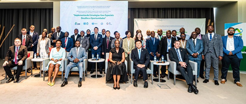
The five-day event, under the overarching theme “Implementing geospatial strategies: challenges and opportunities,” focused on considering strategic approaches to address national priorities, understanding major challenges, identifying the main benefits that geospatial information management can bring to countries, and determining the necessary near- and longer-term solutions. The event comprised two parts: a high-level leadership segment during the first two days (24–25 March 2025) to set the stage and provide a status report of collective understandings, achievements, challenges and opportunities to bridge the digital divide and enhance national geospatial information management arrangements for accelerating the SDGs; and an interactive segment with a workshop during the next three days (26–28 March 2025) to discuss country circumstances, perspectives, views, experiences and needs, and to understand key elements of national efforts and priorities towards enhancing geospatial information management arrangements, resources, capacities and leadership, and addressing related challenges and opportunities. An essential aim of the sub-regional workshop was to connect people with knowledge of the problems related to the needs of Southern Africa—with special attention to SIDS and LLDCs—for the overall needs and future development of countries in the region.
The workshop was attended by over 30 participants including nine Southern African countries (Burundi, Cameroon, Comoros, Eswatini, Lesotho, Malawi, Mozambique, South Africa and Zimbabwe), together with national agencies and ministries, United Nations entities, regional organizations, academia and international partners.
.Documentation
-
Welcome, Introductions and Opening
Opening remarks, UN Resident Coordinator and Humanitarian Coordinator for Mozambique, Dr. Catherine Sozi
Opening remarks, Eng. Chinguane Sebastião Marcos Mabote Secretário de Estado dos Transportes
Introduction
-
Session I-1: Setting the Scene
UN-GGIM: Mandates and supporting countries in the implementation of the UN-IGIF
HLG-IGIF: Current priorities and objectives towards the implementation of UN-IGIF
UN-GGKIC: Current priorities and objectives of the Centre in supporting countries
SDG Data Alliance: experiences on implementing the UN-IGIF and establishing SDG Data Hubs
-
Session I-2: Status Reports (countries)
Status reports (countries)
Chair for UN-GGIM Africa
SDG Data Alliance
Health Information System, aligning with the IGIF
-
Session II-3: Developing Leadership through regional/national and multi-stakeholder Cooperation
ArcGIS Solution for the SDGs
Data Sharing and Applications of China’s Natural Resources Satellites and the CACSA
IOM: Displacement Data & Geospatial Insights
Developing Leadership through regional/national and multi-stakeholder Cooperation
Agência Nacional de Desenvolvimento Geo-Especial
Universidade Eduardo Mondlane
-
Session III-1: Identifying Country Needs Against National Priorities
Break out: Introduction
-
Session III-2: Identifying Common National Strategic Priorities and showcasing geospatial value
Break out 1: Views and Priorities
-
Session III-3: Improving cross-sectoral and integrated approaches
Breakout 2: Barriers and opportunities
-
Session IV-4: Identifying common goals and objectives
Implementation of the UN-IGIF and value