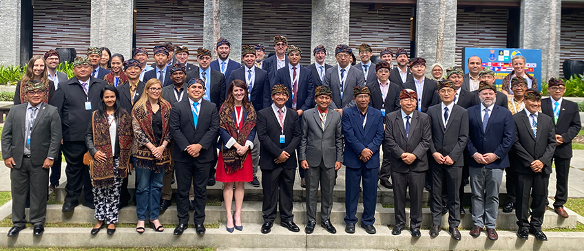
Sixth expert meeting of the Working Group on Marine Geospatial Information
and International Seminar on United Nations Global Geospatial Information Management with the theme
"effective and integrated marine geospatial information management"
Bali, Indonesia 4 - 8 March 2024
A total of forty-nine expert representatives participated in the Sixth expert meeting of the Working Group on Marine Geospatial Information. Forty participants were representatives from eighteen Member States, five from international organizations, three observers, and one staff member who substantively supported and facilitated the weeklong event that included one-day International Seminar on United Nations Global Geospatial Information Management with the theme "effective and integrated marine geospatial information management". The seminar attracted over 100 participants. H.E. Ambassador Rena Lee, Singapore's Ambassador for Oceans and the Law of the Sea delivered the keynote presentation. Referring to the BBNJ/Treaty of the High Seas, concluded her keynote presentation with "from what to do to how to do". The Working Group and its partners have to consider the relevance and contribution of integrated marine geospatial information management to the operationalization of the BBNJ/Treaty of the High Seas. In this regard, the Working Group is challenged to focus on developing practical guidance to support Member States with the "how" for the implementation of the Operational Framework for Integrated Marine Geospatial Information Management (UN-IGIF-Hydro), and contributing to the operationalization of the BBNJ/Treaty of the High Seas.
Participants witnessed and applauded the signing of a cooperation agreement in the official opening segment at the International Seminar between the Geospatial Information Agency and Navy's Hydrographic and Oceanographic Center. Collaboration at the national and sub-national levels are necessary to widen the application of marine geospatial information for a multiplicity of purposes and for national development priorities. The integration of terrestrial, maritime, built and cadastral domains and the strengthening of nationally integrated geospatial information management and its arrangements, resources, capacities and leadership were among key items of work considered. The Working Group will leverage focus work group modality together with the Expert Group on Land Administration and Management, and where appropriate, the Working Group on Policy and Legal Frameworks for Geospatial Information Management, the United Nations Global Geodetic Centre of Excellence, the Singapore-IHO Innovation and Technology Laboratory, bringing together inter-disciplinary expertise to work on, initially, the land-sea interface and the technical complexities related to vertical reference (height datum). This work supports the Committee of Experts programme of work to address climate related challenges, developing practical guidance for Member States in the context of monitoring and measuring sea level rise. The Working Group acknowledged the UN-IGIF-Hydro has to be a 'living document'. In this regard, the Working Group welcomed and accepted the Singapore's offer to digitally publish the UN-IGIF-Hydro to facilitate the maintenance and sustaining the Framework as a living document.
Documentation
-
Provisional annotated agenda
-
International seminar (as at 27 February 2024)
Expert meetings (as at 29 February 2024)
Sixth expert meeting of the Working Group on Marine Geospatial Information (as at 29 February 2024)
Logistical and information note
List of participants
Photo gallery
Summary notes
Presentation materials
-
Official opening session
-
Keynote address - Rena Lee, Chief Executive/Registrar, Intellectual Property Office of Singapore and Singapore's Ambassador for Oceans and Law of the Sea
-
Session #1 - Availability and accessibility of marine geospatial information for effective governance of seas and oceans
- Mohammad Arief Syafi'i, Geospatial Information Agency, Indonesia
- Ilaria Tani, University of Milano-Bicocca
- Graham Evans, International Cable Protection Committee
-
Session #2 - Implementing the UN-IGIF-Hydro and advancing the conservation and sustainable use of marine resources
- John Nyberg, International Hydrographic Organization
- Andrick Lal, Ocean Management and Literacy, Pacific Community (SPC)
- CheeHai Teo, UNDESA/SD/GGIMS
-
Session #3 - Partnerships and innovations for integrated marine geospatial information management
- Agus Sutrianto, Indonesia Navy's Hydro-Oceanographic Center, Indonesia
- Parry Oei, Maritime and Port Authority of Singapore, Singapore
- Kean Huat Soon, Singapore Land Authority, Singapore
Annual sessions
- Fifteenth session
- Fourteenth session
- Thirteenth session
- Twelfth session
- Eleventh session
- Past sessions
