The United Nations Committee of Experts on Global Geospatial Information Management (UN-GGIM) at its Twelfth Session from 3 - 5 August 2022, with decision 12/111, noted the intention of the Working Group to convene its Fourth Expert Meeting in Genoa, Italy from 30 January to 3 February 2023. Also at the Twelfth Session, UN-GGIM in welcoming the report of the Working Group, noted progress towards an updated workplan for the period 2023 - 2024 that would continue raising awareness, providing guidance and encouraging the availability and accessibility of marine geospatial information for the benefit of society, the environment and the economy.
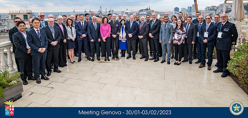
Fifty participants, expert representatives from nineteen Member States, three international organizations and three other academic and private sector entities, met together over five days in a very conducive setting provided by the Italian Hydrographic Institute at Grand Hotel Savoia Genova, and with a coordinated agenda that included the 14th meeting of the IHO-MSDIWG and a meeting of the OGC-MDWG. Apart from attending to the objectives, functions and business of the Working Group, participants worked through the draft Part Two document of the proposed Operational Framework for Integrated Marine Geospatial Information (UN-IGIF-Hydro) cognizant that UN-IGIF-Hydro must provide practical guidance that Member States could use to enhance the availability and accessibility of marine geospatial information. The Working Group also updated its work plan for 2023 - 2024 and adopted a set of decisions before the close of the Fourth Expert Meeting. At the Fourth Expert Meeting, participants were requested to look beyond its traditional responsibility for safety of navigation. Marine geospatial information includes but not restricted to hydrography, oceanography, marine geology, marine biology, human related activities and maritime governance, and that future integrated marine geospatial infrastructures should be integrated with the broader geospatial ecosystem essential for the sustainable development of the world's resources and vital for responding to the impacts of climate change, which is particularly relevant to small island developing States.
UN-GGIM recognized the need to consider the marine environment, namely, inland waters and waterways, shorelines, coastal waters, seas and oceans, as a key component of any national geospatial information management arrangements essential for the effective administration, management and governance of land and marine spaces, and the national geospatial resources of Member States. At its Seventh Session in August 2017, UN-GGIM established the Working Group on Marine Geospatial Information and endorsed its terms of reference. Marine geospatial information encompasses inland water bodies and waterways, coastal zones, seas and oceans contributes to the availability and accessibility of comprehensive location-based information to support Governments in developing policies, priorities and programmes, make decisions, and measure and monitor progress and outcomes. The Working Group aims to play a leading role in marine geospatial information policies at the global level to support the wellbeing of billions of inhabitants reliant on sustainable inland water bodies and waterways, coastal zones, seas and oceans. The Working Group is to provide a forum for dialogue and coordination among Member States, and between Member States and the International Hydrographic Organization, United Nations system and relevant international organizations to enhance global cooperation, advocate and improve the availability and accessibility of integrated marine geospatial information.
-
1. Welcome, introductions and setting the scene
- Agenda item 1 Singapore Statement
-
3. Integrated marine geospatial information management in Italy
- Agenda item 3
-
4. Reports, highlights, updates, and considerations
- Agenda item 4a
- Agenda item 4b
- Agenda item 4c
-
5. Implementing the UN-IGIF in the marine domain and development of the UN-IGIF-Hydro1 Part Two
- Agenda item 5 #1
- Agenda item 5 #2
- Agenda item 5 #3
- Agenda item 5 # 4 - Draft UN-IGIF Hydro Part Two
-
7. Strengthening collaboration, partnerships, engagement, and capacity development
- a. Regional committees of UN-GGIM
- Agenda item 7a #1
- Agenda item 7a #2
- c. ISO Technical Committee 211
- Agenda item 7c #1
- Agenda item 7c #2
- d. Open Geospatial Consortium
- Agenda item 7d #1
- Agenda item 7d #2
- Agenda item 7d #3
- Agenda item 7d #4
- e. Singapore-IHO Innovation and Technology Laboratory
- Agenda item 7e (updated)
Annual sessions
- Fifteenth session
- Fourteenth session
- Thirteenth session
- Twelfth session
- Eleventh session
- Past sessions