- 9 - 11 March 2020
Geospatial information provides the digital connection between a place, its people and their activities, and is used to illustrate what is happening - where, how and why. It is also used to model and portray the impact of the past, the present and likely future scenarios. The 2030 Agenda for Sustainable Development and its seventeen goals are highly dependent on geospatial information and enabling technologies as the primary data and tools for relating people to their place, and to measure 'where' progress is, or is not, being made, particularly at 'disaggregated' sub-national and local levels. The 2030 Agenda specifically demands the need for new data acquisition and integration approaches, including to exploit the contribution to be made by geospatial information and earth observations.
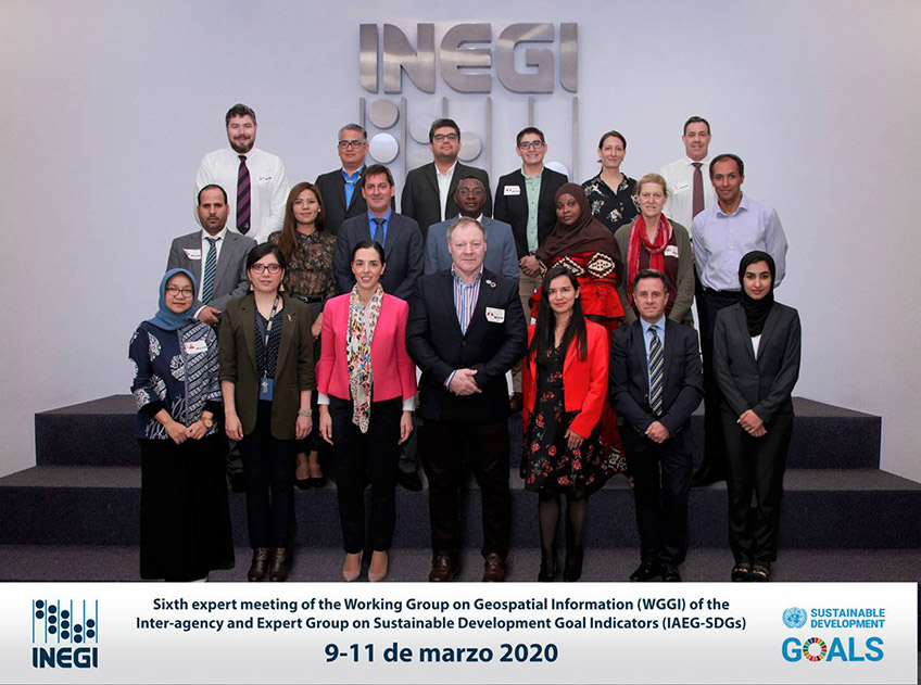
The sixth expert meeting of the Working Group on Geospatial Information of the Inter-agency and Expert Group on Sustainable Development Goals Indicators was hosted by Instituto Nacional de Estadística y Geografía (INEGI). 24 participants participated in the meeting held at INEGI's headquarters in México City, México and another 11 participated remotely. Of these 24 participants, 18 were expert representatives from 7 Member States.
The meeting sought to respond to the call by the Secretary-General for specific actions towards "strengthening collection, access and effective use of data for the Goals; and harnessing science, technology and innovation with a greater focus on digital transformation for sustainable development. The three-day meeting considered both substantive and administrative matters before the Working Group. The Working Group had an updated terms of reference provided by the IAEG-SDGs and with a reconstituted membership with diverse expertise, experience and capacity, considered how geospatial information, earth observations and other data can reliably and consistently contribute to the production and dissemination of indicators. The meeting also considered how the Working Group can improve working modalities with the IAEG-SDGs and custodian agencies, develop guidance and share proven practices in the application of geospatial information for visualisation, dissemination and monitoring of the SDGs, integration of statistics and geospatial information, and data disaggregation. The Working Group planned to develop storytelling documents and guidance on the use of existing frameworks and standards to apply geospatial information for the production of indicators, and for data disaggregation according to geographic location. The meeting agreed on a series of tasks, with deliverables in the near and medium terms, and agreed to update its work plan to incorporate agreed tasks for 2020 - 2021.
9 March 2020
- Providing context for the sixth meeting, reviewing the objectives of the Working Group and towards addressing the needs of the IAEG-SDGs
- The Needs of the IAEG-SDGs
-
- Sixth meeting of the EG-ISGI
- Report and outcomes from the GEO Ministerial and updates from EO4SDGs
Agenda # 3 - Setting the scene: Progress and results of current activities
- Contributions from:
Agenda # 4 - Setting the scene: Perspectives from the IAEG-SDG co-Chairs/Custodian Agencies/UN Secretariat
10 March 2020
- Contributions from:
- Ms. Andrea Fernandez, INEGI, Mexico
- Mr. Alvaro Monett, ECLAC
- Mr. Fabio Volpe, e-Geos, Italy
- Ms. Ousmane Maimouna Ali Baoulhassane, Institut National de la Statisque, Niger
- Ms. Sandra Moreno, DANE, Colombia
- Ms. Celine Jacquin, INEGI, Mexico
- Mr. Kevin McCormack, Central Statistics Office, Ireland
- Mr. Alex Mudabeti, co-Chair of the EG-ISGI and National Statistical Agency, Namibia
- Mr. Abel Coronado, INEGI, Mexico
- Mr. Hugo Sanchez, INEGI, Mexico
- Shortlist of SDG Indicators
- The EO4SDGs Toolkit
- Ms. Paloma Merodio, co-Chair of the Working Group
Agenda # 5 - National experiences and good practice in visualising, disseminating and monitoring SDGs
Agenda # 6 - Developing guidance for the IAEG-SDGs, custodian agencies and the broader statistical community
11 March 2020
Agenda # 7 - Revising the Work Plan
Agenda # 1 - Welcome, Introductions and Overview
Agenda # 2 - Setting the scene: The Working Group on Geospatial Information from 2016 to today
Annual sessions
- Fifteenth session
- Fourteenth session
- Thirteenth session
- Twelfth session
- Eleventh session
- Past sessions