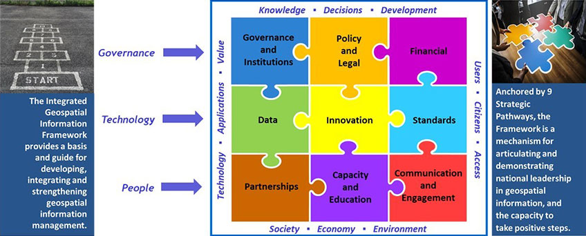
The United Nations Integrated Geospatial Information Framework (UN-IGIF) provides a basis and guide for developing, integrating, strengthening and maximizing geospatial information management and related resources in all countries. It will assist countries in bridging the geospatial digital divide, secure socio-economic prosperity, and to leave no one behind.
The UN-IGIF comprises three parts as separate, but connected, documents: Part 1 is an Overarching Strategy; Part 2 is an Implementation Guide; and Part 3 is a Country-level Action Plan. The three parts comprise a comprehensive Integrated Geospatial Information Framework that serve a country's needs in addressing economic, social and environmental factors; which depend on location information in a continually changing world. The Implementation Guide communicates to the user what is needed to establish, implement, strengthen, improve, and/or maintain a national geospatial information management system and capability.
The UN-IGIF focuses on location information that is integrated with any other meaningful data to solve societal and environmental problems, acts as a catalyst for economic growth and opportunity, and to understand and take benefit from a nation's development priorities and the Sustainable Development Goals.