Virtual High-Level Forum Events on United Nations Global Geospatial Information Management
- 26 May, 2 June and 9 June 2020 11:00 hrs (UTC - Coordinated Universal Time)
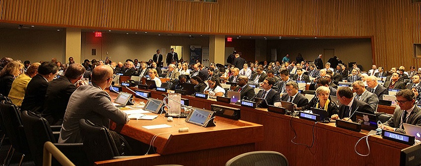
Virtual High-Level Forum Events
The Virtual High-level Forum Events on United Nations Global Geospatial Information Management were successfully convened and streamed virtually to an audience on all five continents. This series of three virtual events were held on 26 May, 2 June and 9 June 2020, each event last just over three hours. These events were jointly organized by UN Statistics Division, as Secretariat for the United Nations Committee of Experts on Global Geospatial Information Management (UN-GGIM), and Ordnance Survey of Great Britain.
The three events addressed the geospatial landscape, that included strategic overviews of the United Nations Integrated Geospatial Information Framework and the Future Trends in Geospatial Information Management: Five to Ten-year Vision; the Integrated Geospatial Information Framework, with its nine strategic pathways for articulating and demonstrating national leadership in geospatial information, and with country-level action plans, the capacity to take positive steps; and the third edition of UN-GGIM Future Trends in Geospatial Information Management that provides expert views and strategic insight on the mid to long term-developments and emerging trend in geospatial information including the role of government.
These events also witnessed the launch of the Implementation Guide of the Integrated Geospatial Information Framework and the Future Trends in Geospatial Information Management: Five to Ten-year Vision third edition, both of which are presently undergoing broad global consultation and review processes. Both the Implementation Guide and the Future Trends report are of significant relevance to our global geospatial community.
Event #1
The Geospatial Landscape, and overview of Integrated Geospatial Information Framework and Future Trends in Geospatial Information Management
26 May 2020, Tuesday
12:00 noon (BST - British Summer Time)/11:00 hrs (UTC - Coordinated Universal Time)
Event #2
Integrated Geospatial Information Framework, the nine strategic pathways and country-level action plans
2 June 2020, Tuesday
12:00 noon (BST - British Summer Time)/11:00 hrs (UTC - Coordinated Universal Time)
Event #3
Future Trends in Geospatial Information Management: Five to Ten-year Vision, the relevance and application to national priorities and action plans
9 June 2020, Tuesday
12:00 noon (BST - British Summer Time)/11:00 hrs (UTC - Coordinated Universal Time)
Event #1
11:00 hrs (UTC)
26 May 2020, Tuesday
The Geospatial Landscape, and strategic overview of Integrated Geospatial Information Framework and Future Trends in Geospatial Information Management
- Moderator
- Mr. Stefan Schweinfest, UN-GGIM Secretariat
- Welcome and opening remarks:
- Mr. Stefan Schweinfest, Director, Statistics Division, United Nations
- Mr. Steve Blair, Chief Executive, Ordnance Survey, United Kingdom
- Ms. Thalia Baldwin, Director, Geospatial Commission, United Kingdom
Segment I
The Geospatial Landscape
- Panellists:
- A Government Perspective Ms. Rosamond Bing, Kingdom of Tonga
- A United Nations Perspective Mr. Oliver Chinganya, UN Economic Commission for Africa
- An Industry Perspective Mr. Sanjay Kumar, World Geospatial Industry Council
- Moderated questions
The Integrated Geospatial Information Framework - Strategic Overview
- Presenter:
-
Mr. Greg Scott, UN-GGIM Secretariat
- Moderated questions
The Future Trends in Geospatial Information Management - Strategic Overview
- Presenter:
-
Mr. David Henderson, Ordnance Survey
- Moderated questions
- Wrap up, announcements and concluding remarks:
- Mr. Stefan Schweinfest, Director, Statistics Division, United Nations
Event #2
11:00 hrs (UTC)
2 June 2020, Tuesday
Integrated Geospatial Information Framework, the nine strategic pathways and country-level action plans
- Moderator:
- Mr. Greg Scott, UN-GGIM Secretariat
- Welcome and opening remarks
- Mr. Greg Scott, United Nations Secretariat for Global Geospatial Information Management
The Integrated Geospatial Information Framework - Nine Strategic Pathways for National Leadership in Geospatial Information Management
- Panellists:
- The Governance Pillar - Strategic Pathways 1, 2 and 3 Mr. Tim Trainor, International Cartographic Association
- The Technology Pillar - Strategic Pathways 4, 5 and 6 Ms. Lesley Arnold, Geospatial Frameworks
- The People Pillar - Strategic Pathways 7, 8 and 9 Mr. John Kedar, Geospatial Initiatives
- Moderated questions
Operationalizing the Integrated Geospatial Information Framework at Country-level
- Panellists:
- The Mongolian Experience Ms. Bayarmaa Enkhtur
- The Guyana Experience Mr. Trevor Benn/Mr. David Cole
- Moderated questions
- Wrap up, announcements and concluding remarks:
- Mr. Greg Scott, United Nations Secretariat for Global Geospatial Information Management
Event #3
11:00 hrs (UTC)
9 June 2020, Tuesday
Future Trends in Geospatial Information Management: Five to Ten-year Vision, the relevance and application to national priorities and action plans
- Moderator
- Mr. David Henderson, Ordnance Survey
- Welcome and opening remarks
- Mr. David Henderson, Ordnance Survey
Future Trends in Geospatial Information Management - the Five to Ten-year vision
- Panellists:
- The Key Technical Trends Mr. Jeremy Morley, Ordnance Survey
- The Trends for Earth Observation Mr. George Percivall, Open Geospatial Consortium
- The Key non-Technical Trends Ms. Christin Walter, Ordnance Survey
- Moderated questions
Impact of Trends on Integrated Geospatial Information Management Priorities, Strategies and Actions Nationally
- Panellists:
- Unlocking Geospatial Value Ms. Edwina Dunn, Geospatial Commission
- ANLIC - Future Trends informing Strategy Ms. Alison Rose, Geoscience Australia
- Facing Future Trends in the Americas Ms. Paloma Merodio Gómez, INEGI México
- Moderated questions
- Wrap up and concluding remarks
- Mr. David Henderson, Ordnance Survey
- Appreciation and closing remarks:
- Mr. Steve Blair, Chief Executive, Ordnance Survey, United Kingdom
- Mr. Stefan Schweinfest, Director, Statistics Division, United Nations
Documents
Events Materials
Event #1 - 26 May 2020, Tuesday
Segment IThe Geospatial Landscape
- A Government Perspective Ms. Rosamond Bing, Kingdom of Tonga
- A United Nations Perspective Mr. Oliver Chinganya, UN Economic Commission for Africa
- An Industry Perspective Mr. Sanjay Kumar, World Geospatial Industry Council
Segment II
The Integrated Geospatial Information Framework - Strategic Overview
Segment III
The Future Trends in Geospatial Information Management - Strategic Overview
Event #2 - 2 June 2020, Tuesday
The Integrated Geospatial Information Framework - Nine Strategic Pathways for National Leadership in Geospatial Information Management- Welcome and opening remarks Mr. Greg Scott, United Nations Secretariat for Global Geospatial Information Management
Segment IV
The Integrated Geospatial Information Framework - Nine Strategic Pathways for National Leadership in Geospatial Information Management
- The Governance Pillar - Strategic Pathways 1, 2 and 3 Mr. Tim Trainor, International Cartographic Association
- The Technology Pillar - Strategic Pathways 4, 5 and 6 Ms. Lesley Arnold, Geospatial Frameworks
- The People Pillar - Strategic Pathways 7, 8 and 9 Mr. John Kedar, Geospatial Initiatives
Segment V
Operationalizing the Integrated Geospatial Information Framework at Country-level
- The Mongolian Experience Ms. Bayarmaa Enkhtur
- The Guyana Experience Mr. Trevor Benn/Mr. David Cole
Event #3 - 9 June 2020, Tuesday
Future Trends in Geospatial Information Management: Five to Ten-year Vision, the relevance and application to national priorities and action plans>- Moderator Mr. David Henderson, Ordnance Survey
Segment VI
Future Trends in Geospatial Information Management - the Five to Ten-year vision
- The Key Technical Trends Mr. Jeremy Morley, Ordnance Survey
- The Trends for Earth Observation Mr. George Percivall, Open Geospatial Consortium
- The Key non-Technical Trends Ms. Christin Walter, Ordnance Survey
Segment VII
Impact of Trends on Integrated Geospatial Information Management Priorities, Strategies and Actions Nationally
- Unlocking Geospatial Value Ms. Edwina Dunn, Geospatial Commission
- ANLIC - Future Trends informing Strategy Ms. Alison Rose, Geoscience Australia
- Facing Future Trends in the Americas Ms. Paloma Merodio Gómez, INEGI México
Recordings
- Tuesday 26 May 2020, Recordings #1
- Tuesday 26 May 2020, Recordings #2
- Tuesday 26 May 2020, Recordings #3
- Tuesday 2 June 2020, Recordings #4
- Tuesday 2 June 2020, Recordings #5
- Tuesday 2 June 2020, Recordings #6
- Tuesday 9 June 2020, Recordings #7
- Tuesday 9 June 2020, Recordings #8
- Tuesday 9 June 2020, Recordings #9