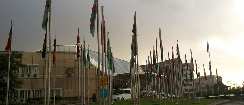
The United Nations Committee of Experts on Global Geospatial Information Management (UN-GGIM), in collaboration with the Government of Ethiopia and the United Nations Economic Commission for Africa (UNECA), successfully convened the Fourth High Level Forum on United Nations Global Geospatial Information Management at UNECA's Headquarters in Addis Ababa, Ethiopia, from 20-22 April 2016.
With the overarching theme 'Good Land Governance for the 2030 Agenda' the High Level Forum was opened by H.E. Dr. Mulatu Teshome, President of the Federal Democratic Republic of Ethiopia. Bringing all stakeholders together, the Forum provided Member States and geospatial stakeholders with the unique opportunity to share and learn from each other, new ideas, methods and strategies to support local, regional and global land administration and management initiatives. It also raised political awareness and highlighted the importance to decision makers of the need for timely and fit for purpose land administration and management; facilitated coordination and dialogue among global experts from the land administration and geospatial communities to strengthen the use of geospatial information for good land governance; and collaborated with professional bodies and experts working in land governance, including United Nations bodies and other international organizations, to identify and address common issues of land management and governance in support of sustainable development.
The Forum began with a Ministerial Segment with Ministers sharing their views on the role of geospatial information management to support good land governance for the 2030 Agenda. Each of the sessions consisted of keynote presentations, panel presentations and discussion with the audience. Recognizing the importance of geospatial information in national and global development, participants issued the Addis Ababa Declaration at the conclusion of the Forum.
List of Documents
- Detailed Agenda (as of 13 April 2016)
- Information Note for participants (UPDATED as of 18 February 2016)
- List of Selected Hotels in Addis Ababa (with email address and contact number)
- Side Event Calendar (as of 20 April 2016)
- Side Event Documents
- List of participants
- Announcement Letter
- Concept Note
- Flyer
Outcome of the Fourth High Level Forum on Global Geospatial Information Management (GGIM)
Opening Ceremony
- Moderator: Mr. Sultan Mohammad, Director General, Ethiopian National Mapping Agency and Chair, UN-GGIM: Africa
- Remarks
- H.E. Mr. Stefan Schweinfest, Director, United Nations Statistics Division
- H.E. Dr. Li Pengde, Co-Chair, UN-GGIM Committee of Experts
- H.E. Dr. Christiaan Lemmen, Joint Board of Geospatial Information Societies
- H.E. Dr. Carlos Lopes, Executive Secretary, Economic Commission for Africa, United Nations
- Opening Statement:
Ministerial Segment
- Mr. Tim Trainor, Co-Chair, UN-GGIM, USA
- Keynote Ministerial Statement
- H.E. Yinager Dessie Belay, Commissioner of National Planning, Ethiopia
Presentation Materials
Session 1: Land Information for Sustainable Development
- Moderator: Mr. Stefan Schweinfest, Director, UNSD
- Land information data needs for SDGs, targets and indicators
- Panel
- Mr. Bengt Kjellson, Sweden
- Mr. Teo CheeHai, Malaysia
- Dr. Ayo Ajayi, Bill & Melinda Gates Foundation
- Mr. Dozie Ezigbalike, UNECA
- Addressing the challenges confronting countries
- Keynote: Mr. Mahashe Chaka, Lesotho
- Panel
- Mr. Edwin Guvaza, Zimbabwe
- Mr. Khadidja Benkouider, Algeria
- Prof. Jide Kufoniyi, President, AARSE
- Mr. Mmboneni Muofhe, GEO, South Africa E
- Mr. Durk Haarsma, GIM International
Session 2: Good Governance and Regulatory Frameworks
- Moderator: H.E. Yinager Dessie Belay, Commissioner of National Planning, Ethiopia
- High Level Policy Dialogue:
- Panel
- Minister, Germany
- Minister, Cameroon
- Minister, Namibia
- Other Ministers TBC
- Role of geospatial information in good land policy and governance
- Moderator: Mr. John Kedar, United Kingdom
- Keynote: Mr. Oumar Sylla, UN-Habitat
- Panel
- Mr. Rik Wouters, Netherlands
- Mr. Uzo Okafor, Namibia
- Mr. Mark Iliffe, World Bank
- Mr. Rolando Ocampo, Mexico
- Dr. Hussein Farah, RMCRD, Kenya
Session 3: Geospatial Land Information Management
- Moderator: Mr. Rolando Ocampo, Co-Chair, UN-GGIM, Mexico
- Addressing the data and information needs
- Panel
- Ms. Clare Hadley, United Kingdom
- Mr. Rolf Becker, GeoDyne
- Mr. Rohan Richards, Jamaica
- Dr. Edouard Fonh Gbei, Côte ďIvoire
- Dr. Guo Renzhong, Shenzhen Municipality, China
- Geospatial land data elements
- Panel:
- Mr. Mmuso Riba, South Africa
- Dr. Joep Crompvoets, Belgium
- Mr. Efren Carandang, Philippines
- Mr. Palitha Udayakantha, Sri Lanka
- Mr. Matthew Delano, Trimble
Session 4: Technology and Capacity Development
- Moderator: Mr Bengt Kjellson, Sweden
- Use and adoption of ICT and geospatial data for land management
- Dr. Stuart Minchin, Australia
- Mr. Brent Jones, Esri
- Mr. Steven Ramage, What3Words
- Dr. Cao Chunhua, Chongqing Municipality, China
- Mr. Alain Kabamba, Hexagon
- Keynote: Dr. Jacqueline McGlade, UNEP
- Panel
Session 5: Shared Objectives and Partnerships
- Moderator: Ms. Dorine Burmanje, Netherlands
- Ms. Kathrine Kelm, World Bank
- Panel
- Mr. Malakai Finau, Fiji
- Ms. Julie Barry, UNECE WPLA
- Mr. Abdoulaye Belem, Burkina Faso
- Ms. Andiswa Mlisa, AfriGEOSS
- Mr. Andre Nonguierma, UNECA
Concluding Session
Side event documents
- Working Group Disasters (19 April 2016)
- Summary of the WG-Disasters Meeting on 19 April 2016, during the 4th UN-GGIM High Level Forum in Addis Ababa
- Update on progress of Task Team 2 of WG-Disasters (19 April 2016)
- (Draft) Strategic Framework on Geospatial Information and Services for Disasters (19 April 2016)
- First meeting of the Group of Experts on Land Administration and Management (19 April 2016)

