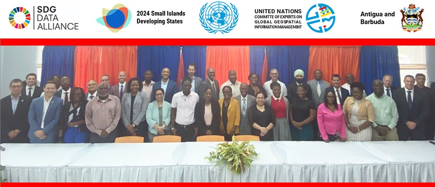
In making decision 14/101 at its fourteenth session from 7-9 August 2024, the Committee of Experts reiterated the importance of strengthening and enhancing national geospatial information management arrangements, capacity, capability and leadership, and urged for sustained national investments in national geospatial programs. The Expert Consultation and Meeting on Enhancing Geospatial Information Management Arrangements and Accelerating the Implementation of the Sustainable Development Goals together with the Sub-regional Workshop on United Nations Integrated Geospatial Information Framework for the Caribbean was convened at a critical juncture in the global development agenda cycle, just after the adoption of the Pact for the Future and its accompanying Global Digital Compact. With the overarching theme 'Identifying Problems, Finding Solutions', the Expert Consultation and Meeting was the fourth of five proposed consultations and meetings contributing to enhance national geospatial information management capabilities for Member States and to sustain national investments in national geospatial programs. The event also aimed to support the implementation of the recent outcome document of the United Nations SIDS4 Conference the "Antigua and Barbuda Agenda for Small Island Developing States (ABAS): A Renewed Declaration for Resilient Prosperity" and therefore considered how to accelerate the implementation of global geospatial frameworks and strategies and leverage the UN-IGIF as a mechanism to enhance nationally integrated geospatial information arrangements and effectively contribute to national development priorities, ABAS and the SDGs.
The event comprised of two parts. A high-level 'leadership' segment during the first two days (21-22 October) as a means for geospatial leaders from Member States in the Caribbean, relevant international and regional entities including the Economic Commission for Latin America and the Caribbean, and subject-matter experts and stakeholders allowed to set the stage and provided a 'status report' and current situational analysis of the collective understandings, challenges, opportunities, capacity/capabilities/gaps, future expectations and needs, along with the required leadership actions to address the geospatial challenges and opportunities in the Caribbean region. A more interactive segment (workshop) during the next three days (23-25 October) aimed to listen to country circumstances, perspectives, views, experiences and needs, to interact, discuss, and understand key elements of national efforts and priorities towards enhancing national geospatial information management arrangements, resources, capacities and leadership, and to address challenges and opportunities. An essential part of the Sub-regional Workshop's aim was to connect people with knowledge of the problems related to the needs of the Caribbean with those who are able to provide possible platforms and solutions where geospatial information, and related technologies can have the greatest impact for the overall needs and future development of the Caribbean countries.
The five-day event transitioned from a 'problem-oriented' to a 'solutions-orientated' approach during the week, including shifting from trying to solve tactical problems to focusing on more strategic issues as Caribbean SIDS seek to understand their major challenges and specific geospatial information management needs of their countries - and to determine the necessary near and longer-term solutions. The meeting was opened by the Honorable Sir Steadroy Benjamin, Acting Prime Minister and Attorney General of Antigua and Barbuda who stated that Antigua and Barbuda recognizes geospatial Information "is crucial for planning, decision-making, and implementation across various sectors-health, education, agriculture, urban planning, and environmental management." The event was organized jointly by the Government of Antigua and Barbuda, through its Surveys and Mapping Division, Ministry of Agriculture, Lands, Fisheries and Blue Economy, the SDG Data Alliance, the Small Island Developing States Unit, Division for Sustainable Development and the Global Geospatial Information Management Section, Statistics Division, both in the Department of Economic and Social Affairs of the United Nations. The meeting welcomed over 30 participants from seven Member States in the Caribbean, regional organizations including ECLAC, OECS, PAHO, and relevant regional stakeholders. Participants to the meeting agreed on several follow-up actions including to continue drafting a list of national priorities for Caribbean SIDS towards a common geospatial strategy for the Caribbean, to develop a coordinated communication mechanism, to prepare regional showcases on impacts, to establish quarterly virtual meetings, beginning with countries and regional entities represented in the workshop. To further improve communication and intra-regional cooperation, group emails and community chats were suggested, outline national data inventory based on the fourteen Global Fundamental Geospatial Data Themes, to scope a capacity development and technical assistance initiative on the implementation of the UN-IGIF, to initiate sharing of data through the SIDS Global Data Hub, and assembling a technical/policy team to advocate at highest levels the value and significance of geospatial information for the region.
Welcome, Introductions and Opening
Session I-1: Setting the Scene: Why Are We Here?
Session 1-2: Status Reports
-
Country reports
- Antigua & Barbuda
- Bahamas
- Barbados
- Guyana
- Saint Kitts and Nevis
- Saint Lucia
- Saint Vincent and the Grenadines

