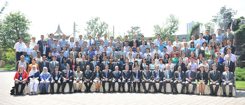
The International Workshop on Integrating Geospatial and Statistical Information was convened in Beijing, China, from 9-12 June 2014. The Workshop was organized by the United Nations Statistics Division, as the Secretariat of the UN Statistical Commission and the UN Committee of Experts on Global Geospatial Information Management (UN-GGIM), and the National Administration of Surveying, Mapping and Geoinformation (NASG) of China, and substantively supported by the Regional Committee of United Nations Global Geospatial Information Management for Asia and the Pacific (UN-GGIM-AP). Attended by 147 participants from 41 countries, the meeting made a significant contribution to the global consultation and communication with relevant experts about the development of a global statistical-geospatial framework, initiated by the UN Statistical Commission and UN-GGIM, and the work of the recently established Expert Group on the Integration of Statistical and Geospatial Information. The Workshop discussed and demonstrated the importance of geography and geospatial information to census activities, and for collecting, processing, storing, integrating, aggregating, and disseminating the data on appropriate platforms. The Workshop also provided the opportunity for participants to share country experiences of the benefits that national geospatial information authorities have derived from meeting the specific needs of census geography/cartography and statistical analysis, and their overall cooperation with national statistical offices.
List of Documents
- Concept Note (14 April 2014)
- Program Agenda (as of 11 June 2014)
- Information Note
- Registration form
- Summary
- List of participants
- Photos
Opening Ceremony
- Mr. Greg Scott (UNSD), Opening Statement
- Ms. Gemma Van Halderen (Australia), Opening Statement
- Mr. Kurexi Maihesuti, Vice Minister, Ministry of Land and Resources and Director General, NASG of China
National Keynote Address
International Keynote Address
- Prof. Paul Cheung (Singapore), Using Location Information For Better Planning and Decision Support: Integrating Big Data, Official Statistics, Geo-information
- Mr. Rolando Ocampo, Vice-President (Mexico), UN-GGIM and NSO's
- Ms. Gemma Van Halderen, First Assistant Statistician, Australian Bureau of Statistics, Australia
Presentation Materials
Session 1: Country experiences in integrating statistical and geospatial information using geography
- Mr. Md. Nojibur Rahman (Bangladesh), Bangladesh Country Experience in Integrating Statistical and Geospatial Information using Geography: Building on past tradition, recent achievements and looking forward to future possibilities
- Mr. Sameh Al-Araimi (Oman), Integrating Geospatial and Statistical Information
- Ms. Marie-Therese Gopal (Seychelles), Integrating Statistical and Geospatial information using geography Seychelles
- Lt. Col. Eng. Mehmet Sabri Sehsuvaroglu (Turkey), Turkey experience in integrating statistical and geospatial information using geography
- Prof. Chen Jun (China), Geo-spatial Statistics with Globalland30
- Ms. Veniana Wainiqolo (Fiji), Fiji's thoughts & experience on integrating statistics & GIS
- Ms. S. Enkhtuya (Mongolia), Mongolian National Spatial Data Infrastructure
- Ms. Rosalind Quartey (Ghana), Country Experiences in Integrating Statistical and Geospatial Information
Session 2: Approaches to determine and represent geographical units, including geocoding, for statistics
- Mr. Martin Brady (Australia), Integration of Statistical and Geospatial Information-A Statistical Spatial Framework
- Mr. Janusz Dygaszewicz (Poland), Creation and usage of geospatial data in Central Statistics Office of Poland
- Mr. Abdullah M. Alhamlan (Saudi Arabia), Working with Census Operations Case Study from KSA
- Mr Rachid Zoubir (Morocco), The Moroccan Experience
- Mr. Elpidio Nogales Jr,. (Philippines), Approaches to Determine and Represent Geographical Units Including Geocoding, for Statistics: Philippine Experience
- Mr. Peter Nwilo (Nigeria), Approaches to Determining and Representing Geographical Units, including Geocoding for Statistics
- Mr. Sisira Tennakoon (Sri Lanka), Approaches to Determine and Represent Geographical Units, Including Geocoding, for Statistics
Session 3: Comparison of grid-based versus administrative approaches to the collection, compilation and dissemination of statistics
- Mr. Vincent Loonis (France), Dissemination of Sensitive Variables in a (200m)2 Grid Dataset: The French Experience
- Mr. Rolando Ocampo (Mexico), Comparison of grid-based versus administrative approaches to the collection and dissemination of statistics
- Ms. Isra Natalisa Gintin (Indonesia), Grid-based versus Administrative Approaches
- Mr. Tim Trainor (USA), Challenges for Data Dissemination: Small Geographic Areas and Statistical Grids
- Prof. Zhang Jixian (China), Integrating Geospatial and Statistical Information for Geographical Conditions Monitoring of China
- Ms. Emma Odhiambo (Kenya), Geographic Classification and Geo-coding in Kenya
Session 4: Statistical analysis of geospatial (environmental, social, etc.) information, and relevance of SDIss and international standards
- Mr. Claudio Stenner (Brazil), Statistical analysis of geospatial information and relevance of SDI’s Standards The Brazilian case
- Ms. Linda Peters (Esri), Statistical analysis of geospatial information, relevance of SDI’s and international standards
- Mr. Ng Siau Yong (Singapore), Seeing Statistics Through Lens of a Map
- Mr. Krishna Raj (Nepal), Integration of Geospatial and Statistical Information: The Nepelese Experience
- Ms. MennatAllah Anwar Ahmed Mohamed Hashim (Egypt), Statistical analysis of geospatial (environmental, social, etc.) information, and relevance of SDI's and international standards
- Mr. Martin Brady (Australia), Implementing the Australian Statistical Geography Standard (ASGS)
Session 5: Positioning for the future. Trends in technology, big data, 2020 Round of Censuses, and the post-2015 development agenda
Annual sessions
- Fifteenth session
- Fourteenth session
- Thirteenth session
- Twelfth session
- Eleventh session
- Past sessions

