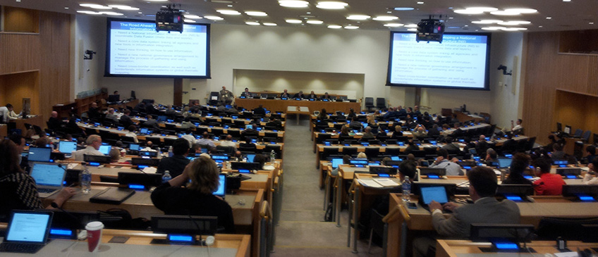
The United Nations Global Forum on the Integration of Statistical and Geospatial Information took place in the UN Headquarters in New York from 4-5 August 2014. The Forum was organized by the United Nations Statistics Division (UNSD), as the Secretariat of the UN Statistical Commission and the UN Committee of Experts on Global Geospatial Information Management (UN-GGIM), and substantively supported by the United Nations Expert Group on the Integration of Statistical and Geospatial Information (UN EG-ISGI).
Convened in accordance with Statistical Commission decision 44/101 and UN-GGIM decision 3/107, which welcomed the proposal to organize an international conference as a way of reaching out and developing best practices bringing together both statistical and geospatial professional communities, the Global Forum brought together senior leaders from both professional communities to discuss the strategic vision and goals for the integration of statistical and geospatial information.
The Global Forum aimed to continue the global consultation and communication on the development of a global statistical-geospatial framework, initiated by the UN Statistical Commission and UN-GGIM, and the work of the Expert Group on the Integration of Statistical and Geospatial Information. It took place in conjunction with the fourth intergovernmental session of the UN Committee of Experts on Global Geospatial Information Management (UN-GGIM), to be held in New York, from 6-8 August 2014.
List of Documents
- Announcement Letter
- Flyer
- Concept Note
- Provisional Agenda
- Information Note
- Discussion Paper: Global Geocoding and Classification Practices
- List of Participants
- Summary of the Forum
- Photos
Welcome and Opening Session
- Opening and welcome [UN EG-ISGI Chairs]
- Opening Remarks [UNSD Director]
- Opening and welcome [UN EG-ISGI Chairs]
Keynote Presentations
- Prof. Nassim Nicholas Taleb, Statistics and Fat Tails
- Ambassador Múnera, Secretary General of the Association of the Caribbean
- Prof. Paul Cheung (UNSD), Using Location Information For Better Planning and Decision Support: Integrating Big Data, Official Statistics, Geo-information
Presentation Materials
Session 1: Positioning for the future-Determining the desired vision for the integration of statistical and geospatial information
- Mr. Rolando Ocampo, (Mexico), Integration of Statistical and Geospatial Information The Global Journey so far
- Mr. Ekkehard Petri (Eurostat), A regional perspective on what has been done so far to achieve the vision of integrated statistical and geospatial information, and how the journey is going
- Mr. Edouardo Sojo, Mexico
- Mr. Peter Harper (Australia), Articulation of the vision
Session 2: Achieving the vision-a global framework
- Ms. Sharthi Laldaparsad (South Africa), "Achieving the Vision" Geo-statistical integration addressing South Africa's Developmental Agenda
- Ms Susanne Schnorr-Bãecker (Germany), Data Management: Geocoded Unit Record Data-Confidentiality Management and Geocoded Unit Record Data: Lessons from Germany
- Mr. Tim Trainor (USA), Common Geographic Boundaries: Small Area Geographies, Administrative, and Grid-based Geographies-One or Many?
- Mr. Mark Reichardt (OGC), Integration of Statistical and Geospatial Information: Metadata Standards and More
- Mr. Peter Harper (Australia), Dimensions of quality in statistical & geospatial datasets
- Ms Marie Haldorson (Sweden), The example of Sweden
- Ms Monica Brezzi (OECD), How's Life in your Region? Measuring Regional and Local Well-being for Policy Making
- Mr. Ivo Havinga (UNSD), SEEA, accounts for the integration of economic, social and environmental statistics
Session 3: Population Census-an exemplar for integration
- Mr. Joao Bosco de Azevedo (Brazil), Brazilian Approach for Geographical Classification and Dissemination of Statistical Data
- Mr. Janusz Dygaszewicz (Poland), The Polish Modern Census: incorporating geospatial technology and data with administrative information
- Ms. Margaret Mbogoni (UNSD), 2020 Round of population and housing censuses: Why geography matters
Session 4: How to get there-the strategic opportunities
Annual sessions
- Fifteenth session
- Fourteenth session
- Thirteenth session
- Twelfth session
- Eleventh session
- Past sessions

