
United nations Committee of Experts on Global Geospatial Information Management (UN-GGIM)
The United Nations Economic and Social Council (ECOSOC) established the United Nations Committee of Experts on Global Geospatial Information Management (UN-GGIM) in July 2011 (ECOSOC Resolution 2011/24) as the official United Nations consultative mechanism on global geospatial information management.
The primary objectives of the UN Committee of Experts are to provide a forum for coordination and dialogue among Member States, and between Member States and relevant international organizations, and to propose work-plans with a view to promoting global frameworks, common principles, policies, guidelines and standards for the interoperability and inter-changeability of geospatial data and services.
The terms of reference approved by ECOSOC call upon Member States to designate experts with specific knowledge drawn from the inter-related fields of surveying, geography, cartography and mapping, remote sensing, land-sea and geographic information systems and environmental protection. The Committee also comprises experts from international organizations, who serve as observers.
On 27 July 2016, following a year-long consultative process on the comprehensive review of the work and operations of UN-GGIM, ECOSOC adopted a resolution (2016/27) entitled “Strengthening institutional arrangements on geospatial information management”. This resolution stressed the continued need to strengthen the coordination and coherence of global geospatial information management, in capacity-building, norm-setting, data collection, data dissemination and data sharing, among others, through appropriate coordination mechanisms.
ECOSOC resolution 2011/24 (in all six official languages)
- Arabic - Chinese - English - French - Russian - SpanishTerms of Reference (in all six official languages)
- Arabic - Chinese - English - French - Russian - SpanishECOSOC resolution 2016/27 (in all six official languages)
Arabic | Chinese | English | French | Russian | SpanishSeventh session of the United Nations Committee of Experts on Global Geospatial Information Management (UN-GGIM), UN Headquarters, New York, 2-4 August 2017
The seventh session of the UN Committee of Experts on Global Geospatial Information Management (UN-GGIM) was successfully concluded at 5:00pm on Friday 4 August 2017 with the adoption of the report. The formal Committee session was opened by the Under-Secretary-General of DESA Mr. Liu Zhenmin, who welcomed almost 400 delegates from about 90 countries and international organizations active in the field of geospatial information management. The Committee elected its Bureau - United States (re-elected), China (re-elected), the Netherlands (new) and Cameroon (new). It considered 17 substantive agenda items, including: the contribution of regional committees and UN-GGIM networks to the global geospatial information agenda; strengthening geospatial information management; a global geodetic reference frame; land administration and management; national institutional arrangements; global fundamental geospatial data themes; geospatial information and services for disasters; national geospatial data and information systems; marine geospatial information; legal and policy frameworks, and implementing the 2030 Agenda through geospatial information and its integration with statistics.
Among the significant outcomes of the session were the establishment of two new Working Groups on Legal and Policy Frameworks, and Marine Geospatial Information; the adoption of a Strategic Framework on Geospatial Information and Services for Disasters; the endorsement of an overarching framework for national institutional arrangements on geospatial information; and a collaborative agreement with the World Bank to implement a new initiative to assist low-income countries to develop their national geospatial information systems. The Committee also welcomed the convening of the fifth High Level Forum on United Nations Global Geospatial Information Management, hosted by INEGI of Mexico in Mexico City in November 2017, with an overarching theme “Implementing the Sustainable Development Goals: The Role of Geospatial Technology and Innovation”.
The formal Committee session was accompanied by a lively programme of side events, starting with a Caribbean Training Workshop on Sunday 30 July. A total of 30 side events were very well attended and are testimony of a vibrant professional community. One of the major side events was a Forum on the 2030 Agenda for Sustainable Development “Where is the Data?” Attended by more than 200 participants, the Forum explored how we will measure, monitor and report progress on the 17 SDGs and their associated targets and indicators with geospatial information. A meeting of the Expanded Bureau of the Committee was also convened, which discussed among other things, mechanisms to implement the Strategic Framework of UN-GGIM for the 2017-2021 period.
One year on from the adoption of the ECOSOC resolution on ‘Strengthening institutional arrangements on geospatial information management”, which broadened the mandate of the Committee of Experts, delegates expressed great satisfaction with the efforts to take practical and strategic actions to implement the resolution and strengthen geospatial information management for Member States. These actions include, developing frameworks, guides, norms, standards and methodological development along with normative strengthening and capacity development for geospatial information management; with a particular emphasis on the 2030 Agenda for Sustainable Development.
Opening SESSION
Documents
- Note Verbale - English | French | Spanish
- Announcement Letter
Other documents
- New York Resource Guide - including information on hotels
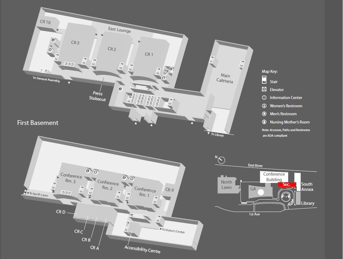
- GA Building lay-out
- Conference Building lay-out
SIDE EVENTS
- GGIM7 Table of Events (as of 27 July 2017)
- Detailed Side Event Calendar (as of 27 July 2017)
- Side event presentation materials
COUNTRY REPORTS
MEETING DOCUMENTS
Document number Document title Summaries Documents E/2017/46-E/C.20/2017/18 Report of the Session Arabic | Chinese | English | French | Russian | Spanish E/C.20/2017/INF/1 Documentation for the Session Report E/C.20/2017/INF/2 List of participants List of participants (Final) E/C.20/2017/1 Provisional Annotated Agenda Arabic | Chinese | English | French | Russian | Spanish E/C.20/2017/1/Add.1 Organization of Work Arabic | Chinese | English | French | Russian | Spanish E/C.20/2017/2 Rules of Procedure Report E/C.20/2017/3 Contribution of regional committees and thematic groups to the global geospatial information agenda | Introduction : Africa | Americas | Arab States | Asia Pacific | Academia | Geospatial Societies | Private Sector Arabic | Chinese | English | French | Russian | Spanish E/C.20/2017/4 Global geodetic reference frame| Introduction | Introduction Arabic | Chinese | English | French | Russian | Spanish E/C.20/2017/5 Determination of global fundamental geospatial data themes Arabic | Chinese | English | French | Russian | Spanish Report E/C.20/2017/6 Trends in national institutional arrangements in global geospatial information management Arabic | Chinese | English | French | Russian | Spanish Report Background documents:
Framework, Principles and Guidelines | Compendium of Good Practices
E/C.20/2017/7 Legal and policy frameworks, including issues related to authoritative data Arabic | Chinese | English | French | Russian | Spanish Report Background documents:
Compendium on Licensing of Geospatial Information |
Working Group Concept NoteE/C.20/2017/8 Implementation and adoption of standards for the global geospatial information community | Introduction Arabic | Chinese | English | French | Russian | Spanish Report E/C.20/2017/9 Integration of geospatial, statistical and other related information | Introduction Arabic | Chinese | English | French | Russian | Spanish E/C.20/2017/10 Application of geospatial information related to land administration and management Arabic | Chinese | English | French | Russian | Spanish E/C.20/2017/11 Geospatial information for sustainable development | Introduction Arabic | Chinese | English | French | Russian | Spanish Report
Background document:
Global Indicators Geospatial shortlistE/C.20/2017/12 Geospatial information and services for disasters | Introduction Arabic | Chinese | English | French | Russian | Spanish E/C.20/2017/13 National geospatial data and information systems Arabic | Chinese | English | French | Russian | Spanish Report
Background document:
Roadmap for CollaborationE/C.20/2017/14 Review of United Nations activities in geospatial information management Arabic | Chinese | English | French | Russian | Spanish Report E/C.20/2017/15 Strengthening geospatial information management Arabic | Chinese | English | French | Russian | Spanish Report E/C.20/2017/16 Marine geospatial information Arabic | Chinese | English | French | Russian | Spanish Report
Background documents:
IHO Report: English | SpanishE/C.20/2017/17 Strengthening collaboration with the UN Group of Experts on Geographical Names | Introduction Arabic | Chinese | English | French | Russian | Spanish Report
Background document:
SIXTH SESSION OF THE UNITED NATIONS COMMITTEE OF EXPERTS ON GLOBAL GEOSPATIAL INFORMATION MANAGEMENT, 1-5 AUGUST 2016, NEW YORK
The Sixth Session of the United Nations Committee of Experts on Global Geospatial Information Management (UN-GGIM) was held from 1-5 August 2016 at the United Nations Headquarters in New York.
Preceded by a number of related side events from 1-2 August 2016, the Sixth Session of UN-GGIM brought together senior executives from national geospatial information and statistical authorities within Member States, and international geospatial experts from across the globe.
With more than 300 participants from 95 countries, 4 international organisations, 8 UN systems and related organizations, 13 non-goverment organizations, 16 private sector and 8 academic network, the discussions and outcomes further recognised and determined the critical role of geospatial information management and the need for strengthened collaboration and joined initiatives, to advance the development and use of geospatial data and tools to support sustainable development and related global agendas.
Opening SESSION
Documents
- Note Verbale - English | French | Spanish
- Announcement Letter
Other documents
SIDE EVENTS
- GGIM6 Table of Events (DRAFT as of 1 August 2016)
- Detailed Side Event Calendar
- Side event presentation materials
Evaluation
MEETING DOCUMENTS
Document number Document title Summaries Documents E/2016/46-E/C.20/2016/15 Report of the Session Arabic | Chinese | English | French | Russian | Spanish E/C.20/2016/INF/1 Documentation for the Session Report E/C.20/2016/INF/2 List of participants List of participants E/C.20/2016/1 Provisional Annotated Agenda Arabic | Chinese | English | French | Russian | Spanish Report E/C.20/2016/1/Add.1 Organization of Work Report E/C.20/2016/2 Rules of Procedure Report E/C.20/2016/3 Contribution of regional committees and thematic groups to the global geospatial information agenda Arabic | Chinese | English | French | Russian | Spanish Report Background document: UN-GGIm Academic Network TOR ; UN-GGIM Academic Network Report by Task Team
E/C.20/2016/4 Global geodetic reference frame Arabic | Chinese | English | French | Russian | Spanish Report Background document: Factsheet GGIM Roadmap
E/C.20/2016/5 Determination of global fundamental geospatial data themes Arabic | Chinese | English | French | Russian | Spanish Report E/C.20/2016/6 Trends in national institutional arrangements in global geospatial information management Arabic | Chinese | English | French | Russian | Spanish Report Background document: Annexes
E/C.20/2016/7 Legal and policy frameworks, including issues related to authoritative data Arabic | Chinese | English | French | Russian | Spanish Report E/C.20/2016/8 Implementation and adoption of standards for the global geospatial information community Arabic | Chinese | English | French | Russian | Spanish Report E/C.20/2016/9 Integration of geospatial, statistical and other related information Arabic | Chinese | English | French | Russian | Spanish Report Background document: Proposal for a Global Statistica Framework; Terms of Reference
E/C.20/2016/10 Application of geospatial information related to land administration and management Arabic | Chinese | English | French | Russian | Spanish Report Background document : UN-EG-LAM Action Plan
E/C.20/2016/11 Activities related to sustainable development and the 2030 Agenda for Sustainable Development Arabic | Chinese | English | French | Russian | Spanish Report Background document: Transforming Our World
E/C.20/2016/12 Geospatial information and services for disasters Arabic | Chinese | English | French | Russian | Spanish Report Background document: Report of Frameworks, Rules, Legislation and Policies on Geospatial Information and Services for Disasters
E/C.20/2016/13 Knowledge base for geospatial information management Arabic | Chinese | English | French | Russian | Spanish Report E/C.20/2016/14 Review of United Nations activities in geospatial information management Arabic | Chinese | English | French | Russian | Spanish Report
FIFTH SESSION OF THE UNITED NATIONS COMMITTEE OF EXPERTS ON GLOBAL GEOSPATIAL INFORMATION MANAGEMENT, 3-7 AUGUST 2015, NEW YORK
The Fifth Session of the United Nations Committee of Experts on Global Geospatial Information Management (UN-GGIM) was held from 3-7 August 2015 at the United Nations Headquarters in New York.
Preceded by a number of related side events from 3-4 August 2015, the Fifth Session of UN-GGIM brought together senior executives from national geospatial information and statistical authorities within Member States, and international geospatial experts from across the globe.
With more than 290 participants from 86 countries, 9 international organisations, 10 UN bodies, and 30 private sector/non-goverment entities, the discussions and outcomes further recognised and determined the critical role of geospatial information management and the need for strengthened collaboration and joined initiatives, to advance the development and use of geospatial data and tools to support sustainable development and related global agendas.
Opening SESSION
- Welcome Address: Mr. Wu Hongbo, Under-Secretary General for Economic and Social Affairs
- Award of Certificate of Appreciation: Co-Chair Dr. Vanessa Lawrence
- UN-GGIM Year in Review
Documents
- Note Verbale - English | French | Spanish
- Announcement Letter
- New York Resource Guide (includes information on hotels)
- Map Exhibition Guidelines
- Orientation Briefing
Other documents
SIDE EVENTS
- UN-GGIM Table of Events (draft as of 31 July 2015)
- Detailed Side Event Calendar
- UN-GGIM 2015 Map/Poster Exhibition
MEETING DOCUMENTS
Document number Document title Summaries Documents E/2015/46-
E/C.20/2015/17Report of the Session Arabic | Chinese | English | French | Russian | Spanish E/C.20/2015/INF/1 Documentation for the Session Report E/C.20/2015/INF/2 List of participants List of participants (revised) E/C.20/2015/1 Provisional Annotated Agenda Arabic | Chinese | English | French | Russian | Spanish Report E/C.20/2015/L.1 Organization of Work Report E/C.20/2015/2 Rules of Procedure Report E/C.20/2015/3 Global geodetic reference frame | Introduction Arabic | Chinese | English | French | Russian | Spanish Report E/C.20/2015/4 Determining global fundamental geospatial data themes Arabic | Chinese | English | French | Russian | Spanish Report E/C.20/2015/5 Trends in national institutional arrangements ingeospatial information management | Introduction Arabic | Chinese | English | French | Russian | Spanish Report Background document: Trends in national institutional arrangements ingeospatial information management
E/C.20/2015/6 Legal and policy frameworks, including issues related to authoritative data | Introduction Arabic | Chinese | English | French | Russian | Spanish Report Background documents: IBA Briefing Note | GGIM-IBA Workshop 2014 | Proposed Geoinformation Convention
E/C.20/2015/7 Implementation and adoption of standards for the global geospatial information community | Introduction Arabic | Chinese | English | French | Russian | Spanish Report E/C.20/2015/8 Integrating geospatial, statistical and other information | Introduction Arabic | Chinese | English | French | Russian | Spanish Report E/C.20/2015/9 The application of geospatial information - land administration and management | Introduction Arabic | Chinese | English | French | Russian | Spanish Report Background document: The Application of Geospatial Information – Land Administration and Management
E/C.20/2015/10 Developing of a statement of shared guiding principles for geospatial information management | Introduction Arabic | Chinese | English | French | Russian | Spanish Report E/C.20/2015/11 Knowledge base for geospatial information management | Introduction Arabic | Chinese | English | French | Russian | Spanish Report Background document: Future Trends Report: Second Edition 2015
E/C.20/2015/12 Coordination of United Nations activities in geospatial information management | UNGIWG | Emergency Response Arabic | Chinese | English | French | Russian | Spanish Report E/C.20/2015/13 Activities related to sustainable development and the post-2015 development agenda Arabic | Chinese | English | French | Russian | Spanish Report E/C.20/2015/14 Programme review of the work of the Committee during the 2011-2015 period Arabic | Chinese | English | French | Russian | Spanish Report E/C.20/2015/15 Contribution of regional committees and thematic groups to the global geospatial agenda | UN-GGIM: Americas | UN-GGIM: Arab States | UN-GGIM: Asia Pacific | UN-GGIM: Europe | JB-GIS Arabic | Chinese | English | French | Russian | Spanish Report Background document: Regional Report UN-GGIM: Americas 2014-2015, English | Spanish
FOURTH SESSION OF THE UNITED NATIONS COMMITTEE OF EXPERTS ON GLOBAL GEOSPATIAL INFORMATION MANAGEMENT, NEW YORK (2014)
The Fourth Session of the United Nations Committee of Experts on Global Geospatial Information Management (UN-GGIM) was held from 6-8 August 2014 at the United Nations Headquarters in New York.
Preceded by a UN Global Forum on the Integration of Statistical and Geospatial Information and a number of technical side events, the Fourth Session of UN-GGIM brought together senior executives from national geospatial information and statistical authorities within Member States, and international geospatial experts from across the globe.
With more than 280 participants from 87 countries, 17 international organisations, 11 UN bodies, and 31 private sector/non-goverment entities, the discussions and outcomes further recognised and determined the critical role of geospatial information management and the need for strengthened collaboration and joined initiatives, to advance the development and use of geospatial data and tools to support sustainable development and related global agendas.
Opening statements
Documents
- Note Verbale (Corrigendum)- English | French | Spanish
- Announcement Letter
- Information Note for Participants (includes information on hotels)
- Session Orientation Guide
Other documents
SIDE EVENTS
UN Global Forum on the Integration of Statistical and Geospatial Information
COUNTRY REPORTS
MEETING DOCUMENTS
| Document number | Document title | Summaries | Documents |
| E/2014/46- E/C.20/2014/15 |
Report of the Session | Arabic | Chinese | English | French | Russian | Spanish | |
| E/C.20/2014/INF/1 | Documentation for the Session | Report | |
| E/C.20/2014/INF/2 | List of participants | List of participants (revised) | |
| E/C.20/2014/1 | Provisional Annotated Agenda | Arabic | Chinese | English | French | Russian | Spanish | Report (Amended) |
| E/C.20/2014/L.1 | Organization of Work | Report (Amended) | |
| E/C.20/2014/2 | Rules of Procedure | Report (Amended) | |
| E/C.20/2014/3 | Global geodetic reference frame | Introduction | Arabic | Chinese | English | French | Russian | Spanish | Report | GGRF Flyer | Newsletter 1 | Newsletter 2 | GGRF PowerPoint | Communication Strategy | GEO Support |
| E/C.20/2014/4 | Determination of global fundamental geospatial data themes | Introduction | Arabic | Chinese | English | French | Russian | Spanish | Report |
| E/C.20/2014/5 | Trends in national institutional arrangements ingeospatial information management | Introduction | Arabic | Chinese | English | French | Russian | Spanish | Report |
| E/C.20/2014/6 | Global map for sustainable development | Introduction | Arabic | Chinese | English | French | Russian | Spanish | Report |
| E/C.20/2014/7 | Legal and policy frameworks, including issues related to authoritative data | Introduction | Arabic | Chinese | English | French | Russian | Spanish | Report |
| E/C.20/2014/8 | Implementation and adoption of standards for the global geospatial information community | Introduction | Arabic | Chinese | English | French | Russian | Spanish | Report | Standards Guide | Standards Companion | NMA Perspective |
| E/C.20/2014/9 | Integration of geospatial, statistical and other information | Arabic | Chinese | English | French | Russian | Spanish | Report |
| E/C.20/2014/10 | Development of a shared statement of principles on the management of geospatial information | Introduction | Arabic | Chinese | English | French | Russian | Spanish | Report |
| E/C.20/2014/11 | Development of a knowledge base for geospatial information management | Introduction | Arabic | Chinese | English | French | Russian | Spanish | Report |
| E/C.20/2014/12 | Coordination of United Nations activities related to geospatial information management | Introduction | Arabic | Chinese | English | French | Russian | Spanish | Report | UNGEGN Document | UNGIWG Document |
| E/C.20/2014/13 | Activities related to sustainable development and the post-2015 development agenda | Introduction | Arabic | Chinese | English | French | Russian | Spanish | Report |
| E/C.20/2014/14 | Reports by regional entities and thematic groups | UN-GGIM: Americas | UN-GGIM: Arab States | UN-GGIM: Asia Pacific | UN-GGIM: Europe | JB-GIS | Arabic | Chinese | English | French | Russian | Spanish | Report |
THIRD SESSION OF THE UNITED NATIONS COMMITTEE OF EXPERTS ON GLOBAL GEOSPATIAL INFORMATION MANAGEMENT, united kingdom (2013)
The Third Session of the United Nations Committee of Experts on Global Geospatial Information Management (UN-GGIM) was held from 24-26 July 2013 at the Corn Exchange Building, Cambridge City Centre, United Kingdom.
Bringing together more than 250 geospatial experts from across the globe, the Third Session of UN-GGIM was convened back-to-back with the Cambridge Conference, and made considerable progress in fulfilling GGIM’s mandate to enhance collaboration and support the use of geospatial information to promote sustainable development globally.
For additional information on the Cambridge Conference you may visit http://www.cambridgeconference.com/conference_2013/.
Documents
- Note Verbale - English | French | Spanish
- Announcement Letter
- Information Note for Participants
- Orientation of the Session
Other documents
SIDE EVENTS
- Table of Side Events as of 16 July 2013
- China Side Event Invitation
MEETING DOCUMENTS
Document number Document title Summaries Documents E/2013/46-E/C.20/2013/17 Report of the Session Arabic | Chinese | English | French | Russian | Spanish E/C.20/2013/INF/1 Documentation for the Session Report E/C.20/2013/INF/2 List of participants List of participants E/C.20/2013/1 Provisional Agenda Arabic | Chinese | English | French | Russian | Spanish Report E/C.20/2013/L.1 Organization of Work Report E/C.20/2013/2 Rules of Procedure Report E/C.20/2013/3 Future trends in geospatial information management Arabic | Chinese | English | French | Russian | Spanish Report | Background Document E/C.20/2013/4 Global Geodetic Reference Frame Arabic | Chinese | English | French | Russian | Spanish Report | Background Document | Background Document | Background Document | Background Document E/C.20/2013/5 Trends in national institutional arrangements in geospatial information management Arabic | Chinese | English | French | Russian | Spanish Report E/C.20/2013/6 Development of a global map for sustainable development Arabic | Chinese | English | French | Russian | Spanish Report E/C.20/2013/7 Legal and policy frameworks, including critical issues related to authoritative data Arabic | Chinese | English | French | Russian | Spanish Report | Background Document E/C.20/2013/8 Establishment and implementation of standards for the global geospatial information community Arabic | Chinese | English | French | Russian | Spanish Report | Background Document E/C.20/2013/9 Linking of geospatial information to statistics and other data Arabic | Chinese | English | French | Russian | Spanish Report E/C.20/2013/10 Critical issues relating to the integration of land and marine geospatial information Arabic | Chinese | English | French | Russian | Spanish Report | Background Document | Background Document E/C.20/2013/11 Development of a shared statement of principles on the management of geospatial information Arabic | Chinese | English | French | Russian | Spanish Report E/C.20/2013/12 Activities on geospatial information within the United Nations system Arabic | Chinese | English | French | Russian | Spanish Report E/C.20/2013/13 Activities related to the United Nations Conference on Sustainable Development Arabic | Chinese | English | French | Russian | Spanish Report E/C.20/2013/14 Development of a knowledge base for geospatial information Arabic | Chinese | English | French | Russian | Spanish Report E/C.20/2013/15 Status of mapping in the world Arabic | Chinese | English | French | Russian | Spanish Report | Background Document [Annex] E/C.20/2013/16 Report by regional entities and thematic groups Arabic | Chinese | English | French | Russian | Spanish Report
SECOND SESSION OF THE UNITED NATIONS COMMITTEE OF EXPERTS ON GLOBAL GEOSPATIAL INFORMATION MANAGEMENT, New York (2012)
The Second Session of the Committee of Experts on Global Geospatial Information Management was held at UN (New York) from 13 - 15 August 2012.
Interpretation in all six languages was provided.
OPENING STATEMENTS
- Mr. Joo-Bin Im, President of the Korean Geographic Information Institute
- Mr. Wu Hongbo, Under-Secretary-General for Economic and Social Affairs
Press Release
MEETING DOCUMENTS
- Country reports for the Second Session
- General Information
Document number Document title Summaries Documents E/2012/46-E/C.20/2012/12 Report of the Session Arabic | Chinese | English | French | Russian | Spanish E/2012/46/Corr.1 - E/C.20/2012/12/Corr. 1 Report of the Session -Corrigendum Arabic | Chinese | English | French | Russian | Spanish E/C.20/2012/INF/2 List of participants List of participants E/C.20/2012/INF/1 Documentation for the Session Report E/C.20/2012/1 Provisional Agenda Arabic | Chinese | English | French | Russian | Spanish Report E/C.20/2012/L.1 Organization of Work Report E/C.20/2012/2 Rules of Procedure Arabic | Chinese | English | French | Russian | Spanish Report E/C.20/2012/3 Future Trends in Geospatial Information Management Arabic | Chinese | English | French | Russian | Spanish Report | Background Document | Presentation E/C.20/2012/4 The preparations of Rio+20 and the contribution of the Committee as well as on the implications of the outcomes of Rio+20 Arabic | Chinese | English | French | Russian | Spanish Report | Background Document | Presentation E/C.20/2012/5 The Inventory of Issues to be addressed by the Committee in Future Sessions Arabic | Chinese | English | French | Russian | Spanish Report E/C.20/2012/6 Consideration of a Statement of Ethics Arabic | Chinese | English | French | Russian | Spanish Report | Presentation E/C.20/2012/7 Development of a GGIM knowledge base Arabic | Chinese | English | French | Russian | Spanish Report E/C.20/2012/8 The International Society for Photogrammetry and Remote Sensing (ISPRS) study on the status of mapping in the world Arabic | Chinese | English | French | Russian | Spanish Report | Background Document | Presentation E/C.20/2012/9 The Global Geodetic Reference System Arabic | Chinese | English | French | Russian | Spanish Report | Presentation E/C.20/2012/10 The Development of a global map for sustainable development Arabic | Chinese | English | French | Russian | Spanish Report | Presentation E/C.20/2012/11 Special Reports on Regional and Thematic Activities Arabic | Chinese | English | French | Russian | Spanish Report | Presentations - PCGIAP, PC-IDEA, Africa, Europe, JBGIS
Bangladesh , Burkina Faso, Canada, China, Côte d'Ivoire, Croatia, Denmark, El Salvador, Fiji, Greece, Italy, Japan, Nepal, Netherlands, New Zealand, Pakistan, Philippines, Romania, Singapore, Spain, Sri Lanka, Turkey, The former Yugoslav Republic of Macedonia, Uruguay.
Invitation Letter
New York Resource Guide including information on hotels
INAUGURAL SESSION (2011)
The Inaugural meeting brought together 350 experts from 90 countries, 22 United Nations representatives and 37 representatives from international organisations and the private sector.
The Forum was opened by Prime Minister Kim Hwang-Sik of the Republic of Korea, United Nations Under-Secretary-General Mr. Sha Zukang, and Prof. Cartwright, President of the Joint Board of Geospatial Information Societies.
The Forum began with a Ministerial Segment with Ministers from eight countries ( Korea, Chile, Finland, India, Malaysia, Mongolia, Namibia, Niger). They all endorsed the important role of geospatial information in policy formulation and evidence-based decision making for national development.
The Terms of Reference of the Committee of Experts was adopted, the Rules of Procedure of the Committee were reviewed, its contribution to Rio+20 was discussed as well as an inventory of critical issues to be addressed by the Committee for future sessions.
Discussed were the importance of collaboration among Member States in developing common frameworks, tools and procedures, the need to share best practices on the impact and usefulness of well implemented national spatial data infrastructures. It was also recognized that the geospatial industry is a key partner in global geospatial information community and noted the importance of continuing the dialogue between governments and industry under the umbrella of UN-GGIM.
The Seoul Declaration was adopted at the end of the Forum.
List of documents
- Official documents
- E/2011/46-E/C.20/2011/7 - Report of the session (Arabic - Chinese - English - French - Russian - Spanish )
- E/C.20/2011/INF/1 - List of participants
- E/C.20/2011/1 - Provisional agenda - (Arabic - Chinese - English - French - Russian - Spanish)
- E/C.20/2011/L.1 - Organization of work - (Arabic - Chinese - English - French - Russian - Spanish)
- E/C.20/2011/2 - Terms of reference
- E/C.20/2011/3 - Rules of procedure of the Committee
- E/C.20/2011/4 - Contribution of the Committee to Rio+20
- E/C.20/2011/5 - Inventory of issues to be discussed by the Committee
- E/C.20/2011/6 - United Nations Maps
- Background documents
- A/CONF.216/PC/7 - Objective and themes of the United Nations Conference on Sustainable Development
- Rio+20 Brochure - "Building Our Common Future"
- Country reports (*)
Australia, Bahrain, Botswana, Burkina Faso, Burundi, Cameroun, Croatia, Egypt, Finland, Germany, Guatemala, Israel, Jamaica, Japan, Madagascar, Malaysia, Namibia, New Zealand, Nigeria, Palestine, Poland, Senegal, Serbia, Spain, Sri Lanka, Sweden, United Kingdom, Uruguay, United States of America, Viet Nam
Scoping papers
By countries
- Australia - Scoping Paper for the Proposed United Nations Committee of Experts on Global Geographic Information Management - English
- Brazil - Data Integration - English
- Burkina Faso - Capacity Building and Technology Transfer for Global Geographical Information Management - English | French
- Japan - Scoping Paper for the Proposed United Nations Committee of Experts on Global Geographic Information Management - English
- Republic of Korea - Reflections on the critical issues in Global Geographical Information Management - English
By organizations
- Scoping Notes for The Preparatory Meeting of the Proposed United Nations Committee of Experts on Global Geographic Information Management
- Global Geographic Information Management: Some Institutional and Data Sharing Issues in Integrating Geospatial and Statistical Data
- View on UN Committee of Experts (UNCoE) on Global SDI proposed by UNSD
- Scoping Notes for The Preparatory Meeting of the Proposed United Nations Committee of Experts on Global Geographic Information Management
- Reflections about a global forum for Geographic Information (GI) management
