Revised Guide to the Role of Standards in Geospatial Information Management unveiled as an online resource for all
9 February 2022
The Open Geospatial Consortium (OGC), International Organization for Standardization Technical Committee 211 on Geographic Information/Geomatics (ISO/TC 211) and the International Hydrographic Organization (IHO) jointly announced the launch of 3rd Edition of the Guide to the Role of Standards in Geospatial Information Management (the "Standards Guide"). The United Nations Committee of Experts on Global Geospatial Information Management (UN-GGIM) endorses this edition during their Eleventh Session in August 2021, in decision 11/111. The Standards Guide is available at http://standards.unggim.ogc.org/
The Standards Guide, now in its 3rd Edition, provides Member States recommendations on the open international standards and good practices necessary to assure that the growing wealth of geospatial data and technologies can be shared, maintained, integrated and applied. This will allow policy- and decision-makers to address a range of local to global, social, economic and environmental challenges. Available now as an interactive web-based resource as well as a downloadable publication, it represents a significant enhancement over prior editions.
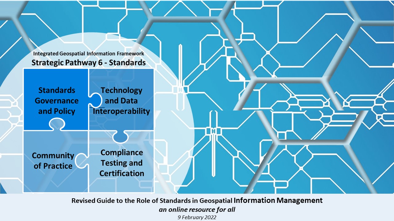
This Standards Guide also now aligns with the United Nations Integrated Geospatial Information Framework (IGIF). The IGIF represents a high-level framework for all, providing a "basis and guide for developing, integrating, strengthening and maximizing geospatial information management and related resources in all countries. It will assist countries in bridging the geospatial digital divide, secure socio-economic prosperity, and to leave no one behind".
The Standards Guide complements the IGIF Strategic Pathway 6 Standards by addressing in detail the role of standards in geospatial information management by:
- Defining and explaining what a standard is;
- Making a case for open standards;
- Discussing why such standards are valuable;
- Describing geospatial standards and related good practices;
- Identifying the intended audience / roles for those who will benefit from using the Standards Guide;
- Introducing a goal-based approach to standards adoption, and a multi-tiered standardization approach to attaining desired levels of geospatial capability;
- Characterizing emerging standards and trends;
- Providing concrete examples of standards in use; and
- Concluding with helpful resources and suggestions for next steps.
The OGC, ISO/TC211, and IHO collectively form the Standards Development Organization (SDO) team as recognized by UN-GGIM. With the Standards Guide in a more readily maintainable digital form, the SDO team will support its regular review, maintenance and enhancement based on advancements of their respective standards. We invite contributions from the global community for inclusion. These should describe exemplar implementations of standards and other resources of value to implementers in the community worldwide.
Publications: Standard Guides
Companion document on Standards Recommendations by Tier Introduction
A Guide to the Role of Standards in Geospatial Information Management: Companion document on Standards Recommendations by Tier