"The benefits of more timely, detailed, and accessible data are many: Geospatial information can bridge gaps, provide a clearer picture of where and how we can do better, and deliver deeper insights and smarter decisions"
António Guterres
Secretary-General of the United Nations
"The benefits of more timely, detailed, and accessible data are many: Geospatial information can bridge gaps, provide a clearer picture of where and how we can do better, and deliver deeper insights and smarter decisions"
António Guterres
Secretary-General of the United Nations
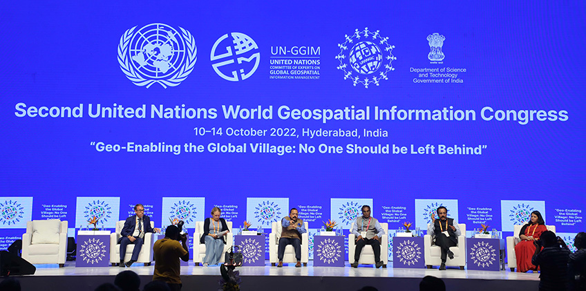
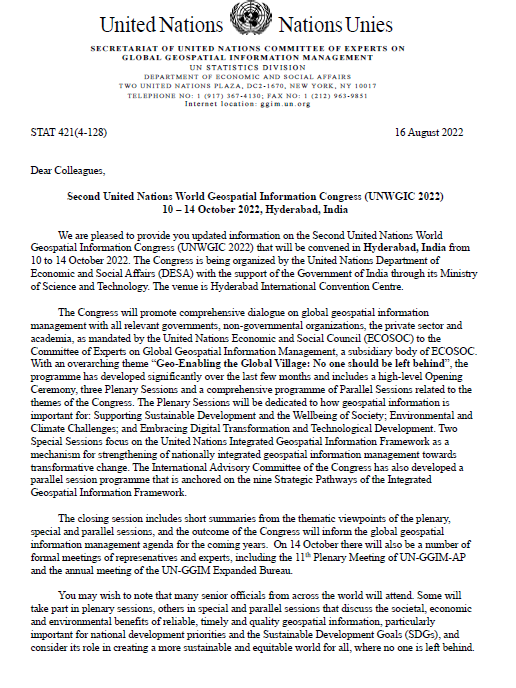
The importance of the 'Community'; 'Collaboration'; and 'Commitment' to the United Nations Integrated Geospatial Information Framework (UN-IGIF) to achieve the Sustainable Development Goals, address climate-related challenges and leave no one behind were emphasized at the Congress hosted by the Government of the Republic of India in Hyderabad. The Congress program, from 11 - 13 October, had three plenary sessions with nine keynote presenters with diverse experience and perspective, and from diverse background and geography. Each addressed the principal focus of the plenary sessions - supporting sustainable development and the wellbeing of society; embracing digital transformation and technological development; environmental and climate challenges and reinforced the importance of working together. Alongside the plenary sessions were four special sessions that were essentially panels comprising predominantly panelists representing national agencies from Member States, and a further forty thematic parallel sessions. All in all there were 121 presenters. Within the Congress week, from 10 - 14 October, there were two special events with particular focus on children, youth and the under-represented. There were also eight side events and three formal meetings.
The UN Secretary-General had a message that was read out before the Prime Minister of India's 12-minute videoed official address at the official opening session on 11 October. The Governor of the State of Telangana provided her closing address at the official closing session on 13 October. In his message, the UN Secretary-General welcomed the theme 'Geo-enabling the global village: No one should be left behind' and appreciated the outreach to the next generation with a dedicated youth forum. This 'youth forum' was the special event titled 'Geo-enabling the Global Village with Generation Z and Alpha' where school children and teachers from 18 schools across India presented their geospatially enabled sustainability projects. Many of these school children stayed on for the rest of the week and were amongst the 1369 participants from 77 countries. In particular, many applauded the inclusion and participation of young adults, school children and the normally under-represented in the Congress program. Participants noted and welcomed the inclusiveness and the diversities within what was a very strong substantive program put together by the International Advisory Committee of the Congress. The program and its presentations and ensuing discussions had overarching focus on the Sustainable Development Goals and the United Nations Integrated Geospatial Information Framework.
"The COVID-19 pandemic should have been a wakeup call for the world in taking everyone along. Billions of people in the developing world needed diagnostics, medicines, medical equipment, vaccines, and more. Yet, they were left to their own fate. There is a need for an institutional approach by the international community to help each other during a crisis. The United Nations can lead the way in taking resources to the last mile in every region. Even in fighting climate change, hand-holding and technology transfer are crucial. We share the same planet. I am sure we can share best practices for saving our planet too. The possibilities that geospatial technology offers are endless. Sustainable urban development, managing and even mitigating disasters, tracking the impact of climate change, forest management, water management, stopping desertification, food security. There is so much that we can do for our planet through geospatial technology."
Narendra Modi
Prime Minister of India
Congress website : https://unwgic2022.in/index.html
UNWGIC 2022 Program Guide
Please click on each Plenary, Thematic Parallel Sessions, Special and Side Events to view the presentation materials
Monday, 10th October 2022
| Time (Hrs) |
G.01-02 |
G.03-04 |
G.05-06 |
| 10:00 - 11:30 |
Side Event #1 - Indian Evolving Geospatial Ecosystem: Dialogue with Global Stakeholders |
Special Event: Geo-enabling the Global Village with Generations Z and Alpha |
|
| 11:30 - 11:45 |
Tea/Coffee Break |
||
| 11:45 - 13:15 |
Special Event: Geo-enabling the Global Village with Generations Z and Alpha |
|
|
| 13:15 - 14:30 |
Lunch Break (Hall 3) |
||
| 14:30 - 16:00 |
Side Event #4 - Bridging Academia and Industry in Geospatial Research, Education and Training |
Special Event: Geo-enabling the Global Village through the Celebration of Multi-faceted Diversity and Inclusion Approaches |
Side Event #3 - Matchmaking Forum for the Indian Geospatial Industry and National Government Agencies |
| 16:00 - 16:30 |
Tea/Coffee Break |
||
| 16:30 - 18:00 |
Side Event #4 - Bridging Academia and Industry in Geospatial Research, Education and Training |
Side Event #3 - Matchmaking Forum for the Indian Geospatial Industry and National Government Agencies |
|
| 18:30 - 21:00 |
Official Welcome Reception (Hall 3) |
||
Tuesday, 11th October 2022
| Time (Hrs) |
Hall 4,5,6 |
|||||||||
| 09:30 - 11:00 | ||||||||||
| 11:00 - 11:30 |
Tea/Coffee Break | Exhibition Opening (Hall 1,2) |
|||||||||
| 11:30 - 13:15 | ||||||||||
| 13:15 - 13:30 |
Geospatial Knowledge Infrastructure Readiness Index and Value Proposition in World Economy, Society, and Environment (Report Launch) |
|||||||||
| 13:30 - 14:30 |
Lunch Break (Hall 3) |
|||||||||
|
|
Ground Floor |
First Floor |
||||||||
|
Novotel Ballroom |
G.01-02 |
G.03-04 |
G.05-06 |
1.01 |
1.02 |
1.03 |
1.04 |
1.05 |
1.06 |
|
|
Parallel Track 4 - Strengthening Capacities, Capabilities and Communications |
Parallel Track 5 - Operationalizing the Integrated Geospatial Information Framework at the Country-level |
Parallel Track 7 - National Development Priorities and the 2030 Agenda for Sustainable Development |
Parallel Track 8 - Integrated Geospatial Information and Earth Observation for Climate Resilience |
Parallel Track 1 - Governance, Policy and Legal Frameworks, and Sustainable Financing |
Parallel Track 2 - Data and Standards |
Parallel Track 3 - Creativity and Innovation |
Parallel Track 6 - Determining the Future Geospatial Information Ecosystem |
Parallel Track 9 - Enabling Geospatial Knowledge, Innovation and Technology via Academia and Private Sector |
Parallel Track 10 - Generations, Diversity and Partnerships |
|
|
14:30 - 16:00 |
TP4A - Capability Development for Sustainability and Resilience |
|
TP2A - Integrated Marine Geospatial Information for Sustainable Oceans, Seas and Coastal Zones |
TP6A - Drivers for the Future Geospatial Information Ecosystem |
TP10A - Celebrating Diversity in Geospatial Information Management |
|||||
| 16:00 - 16:30 |
Tea/Coffee Break | Indian SDGs Showcase: Geospatial in Women Empowerment (G-Chaupal Area: Foyer of Hall G0.6 Ground Floor) |
|||||||||
| 16:30 - 18:00 |
TP4B - Strengthening Capacities for Sustainability and Resilience |
|
|
|||||||
| 19:00 - 21:30 |
Official Congress Dinner (Hall 4) |
|||||||||
Wednesday, 12th October 2022
Thursday, 13th October 2022
| Time (Hrs) |
Hall 4 |
Hall 5,6 |
||||||||
| 09:30 - 11:00 |
Special Session #2A: Modernizing and Transforming National Geospatial Information Arrangements |
|||||||||
| 11:00 - 11:30 |
Tea/Coffee Break | Indian SDGs Showcase: Indigenous Community (G-Chaupal Area: Foyer of Hall G0.6 Ground Floor) |
|||||||||
| 11:30 - 13:15 | ||||||||||
| 13:15 - 14:30 |
Lunch Break (Hall 3) |
|||||||||
|
|
Ground Floor |
First Floor |
||||||||
|
Hall 5 |
G.01-02 |
G.03-04 |
G.05-06 |
1.01 |
1.02 |
1.03 |
1.04 |
1.05 |
1.06 |
|
| 14:30 - 16:00 |
TP4E - Strengthening Geospatial Knowledge for Sustainability |
TP5E - Operationalizing the UN-IGIF According to National Circumstances |
|
|||||||
| 16:00 - 17:00 |
Official Closing Session (Hall 4) |
|||||||||
Friday, 14th October 2022
| Time (Hrs) |
Novotel Ballroom |
G.01-02 |
G.03-04 |
| 09:30 - 11:00 |
Eleventh Plenary Meeting of the Regional Committee of United Nations Global Geospatial Information Management for Asia and the Pacific (UN-GGIM-AP) [hosted by the Survey of India] |
Meeting of the UNWGIC 2022 International Advisory Committee (by invitation) |
Side Event #5 - Space-based Geospatial Activities in India: Applications of Space Technology in the User Ministries |
| 11:00 - 11:30 |
Tea/Coffee Break |
||
| 11:30 - 13:15 |
Eleventh Plenary Meeting of the Regional Committee of United Nations Global Geospatial Information Management for Asia and the Pacific (UN-GGIM-AP) [hosted by the Survey of India] |
Meeting of the UNWGIC 2022 International Advisory Committee (by invitation) |
Side Event #6 - The Importance of Land Administration for the Implementation of the SDGs |
| 13:15 - 14:30 |
Lunch Break (Hall 3) |
||
| 14:30 - 16:00 |
Eleventh Plenary Meeting of the Regional Committee of United Nations Global Geospatial Information Management for Asia and the Pacific (UN-GGIM-AP) [hosted by the Survey of India] |
2022 Meeting of the UN-GGIM Expanded Bureau together with co-Chairs of the UN-GGIM Functional Groups (by invitation) |
|
| 16:00 - 16:30 |
Tea/Coffee Break |
||
| 16:30 - 17:00 |
Eleventh Plenary Meeting of the Regional Committee of United Nations Global Geospatial Information Management for Asia and the Pacific (UN-GGIM-AP) [hosted by the Survey of India] |
2022 Meeting of the UN-GGIM Expanded Bureau together with co-Chairs of the UN-GGIM Functional Groups (by invitation) |
|
Documentation for the Second UN World Geospatial Information Congress
- Information Note
- Calendar of side events and meetings (forthcoming)