Second High Level Forum on Global Geospatial Information Management (GGIM)
Doha, Qatar- 4-6 February, 2013
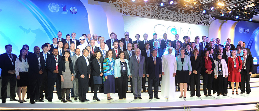
We are pleased to record that the Second High Level Forum on Global Geospatial Information Management (GGIM) was held in Doha, Qatar from 4-6 February, 2013 at the Qatar National Convention Centre.
The Secretariat of the United Nations Committee of Experts on Global Geospatial Information Management (UN-GGIM), in collaboration with the Government of Qatar, successfully convened the Second High Level Forum.
The Forum bought together 350 participants from 60 Member States, international organizations, the private sector, and UN entities who affirmed the importance of UN-GGIM providing global leadership on geospatial information management, and committed to support the ensuing projects and programmes through the Doha Declaration. The participation of Qatar's Prime Minister and the delivery of eight Ministerial Statements also highlighted the importance accorded to UN-GGIM aims and activities.
The activities began on Sunday, 3 February, 2013 with An 'Exchange Forum with the Geospatial Industry'. The High Level Forum began on Monday, 4 February, 2012 with an Opening Ceremony and Ministerial Segment, followed by five technical sessions over the next three days. Each session had a keynote presentation, panel presentations and discussion with the audience.
The discussions were centered on building national geospatial information systems, sharing some of their strategies and successes, an examination of the technological trends impacting the future of geospatial information management and how these technologies can be best leveraged, the challenges experienced and the solutions used to develop geospatial reference data sets, the overwhelming need to use geospatial information to address sustainable development issues, and also emphasized the requirement for UN-GGIM to provide leadership to ensure sustainable geodetic frameworks that are operable nationally, regionally and globally.
The High Level Forum provided the opportunity for Member States of the ESCWA region to meet to discuss UN-GGIM. All 11 Member States present agreed in principle that more regional cooperation on GGIM was needed. UN-ESCWA and the UN-GGIM Secretariat, with the help of other regional GGIM groups, will provide the guidance and support to help the region to establish their own regional GGIM mechanism.
List of Documents
- Announcement Letter
- Annotated Agenda
- Information note
- Regional Side Event (by invitation only)
- Detailed Agenda as of 31 January 2013
Outcome of the Second High Level Forum on Global Geospatial Information Management (GGIM)
- Doha Declaration on Global Geospatial Information Management
- H.E. Sheikh Hamad Bin Jabor Bin Jassim Al Thani (Qatar), Summary by the Chairperson
Opening Address
- H.E. Sheikh Hamad Bin Jabor Bin Jassim Al Thani (Qatar)
- H.E. Sheikh Hamad Bin Jassim Bin Jabor Al-Thani (Qatar), Statement
- H.E. Wu Hongbo, Under-Secretary-General for Economic and Social Affairs, United Nations
- H.E. Vanessa Lawrence, Co-Chair, UN-GGIM Committee of Experts
- H.E. William Cartwright (JB-GIS), Address by Joint Board of Geospatial Information Societies Chair
Ministerial Segment
- Keynote Speech
- H.E. Sheikh Abdul Rahman bin Khalifa Al Thani (Qatar)
Presentation Materials
- Session 1: Building a National Geospatial Information System: Driving Forces, Success Stories
- Mr. Li Pengde (China), Surveying and Mapping Capacity Building and Geoinformation Service in China
- Abstract
- Presentation
- Ms. Vanessa Lawrence (United Kingdom), Building a National Geospatial Information System: Driving Forces, Success Stories
- Abstract
- Presentation
- Mr. Krishna Raj (Nepal), Towards Building a National Geospatial Information System in Nepal
- Abstract
- Presentation
- Mr. Enrique De Alba Guerra (Mexico), Developing a national cadastre under the SNIEG
- Abstract
- Presentation
- Mr. Peter Nwilo (Nigeria), Establishment of National GNSS Network in Nigeria: The Present Status
- Abstract
- Mr. Abdul Kadir bin Taib (Malaysia), Building a National Geospatial Information System: Malaysian's Experiences
- Abstract
- Presentation
- Session 2: Future Trends in Geospatial Information: Growing the Information Base, Promoting Greater Use
- Ms. Vanessa Lawrence (United Kingdom), Future Trends in Geospatial Information: Growing the Information Base, Promoting Greater Use
- Abstract
- Mr. Im, JooBin (Republic of Korea), New Directions for Geospatial Information through the analysis of Korea'scase
- Abstract
- Presentation
- Mr. Sultan Mohammed (Ethiopia), Presentation on Geospatial Information Production and Management in Ethiopia: An Overview
- Abstract
- Mr. Timothy Trainor (USA), Responding to Continually Increasing Geospatial Information Through Capabilities for Exposing Data for Effective Decision Making
- Abstract
- Presentation
- Mr. Vincent Hoong (Singapore), The Future Role of Governments for the Future Geospatial Information Societies
- Abstract
- Presentation
- Mr. William Cartwright (JB-GIS), Joint Board of Geospatial Information Societies
- Abstract
- Presentation
- Session 3: Developing an Effective Global Geodetic Reference Framework and Supporting Location-Based Services Use
- Mr. Hansjorg Kutterer (Germany), Developing an Effective Global Geodetic Reference Framework and Supporting Location-Based Services
- Abstract
- Presentation
- Mr. Uzochukwu Okafor (Namibia), Global Geodetic Reference System in Support of Local Based Services
- Abstract
- Presentation
- Mr. John Dawson (Australia), Positioning Infrastructure: an Australian Perspective
- Abstract
- Presentation
- Mr. Alvaro Monett (Chile), The Spatial Reference for Geomatics in the Americas
- Abstract
- Presentation
- Mr. Nasr Al-Sahhaf (Saudi Arabia), Space Geodesy in the Kingdom of Saudi Arabia
- Abstract
- Presentation
- Mr. Stefano Ghielmetti (Trimble Navigation), The uses, trends, technology and economic benefits of a global reference framework
- Abstract
- Presentation
- Session 4: Geospatial Information and Sustainable Development (Rio+20)
- Mr. Yoshikazu Fukushima (Japan), Global Map for Sustainable Development
- Abstract
- Presentation
- Mr. Claude Obin Tapsoba (Burkina Faso), Vers Une Utilisation Fiable De L'information Geographique Au Burkina Faso
- Abstract
- Ms. Ingrid Vanden Berghe (Belgium), Geospatial Information and Sustainable Development (Rio+20), A Belgian perspective
- Abstract
- Presentation
- Mr. Olaf Magnus Ǿstensen (Norway), Geospatial Information and Sustainable Development (Rio
- Abstract
- Presentation
- Mr. Asep Karsidi (Indonesia), Updates on Development of Nationwide Geospatial Data Management
- Abstract
- Presentation
- Ms. Jacqueline McGlade (EEA), Geospatial Information and Sustainable Development (Rio+20)
- Abstract
- Presentation
- Session 5: Challenges in Developing Core Global Reference Datasets
- Mr. Derek Clarke (South Africa), Challenges in Developing Core Global Reference Datasets
- Abstract
- Presentation
- Ms. Sue Gordon (New Zealand), A framework for establishing fundamental data sets in New Zealand
- Abstract
- Presentation
- Mr. Bengt Kjellson (Sweden), How to create an efficient network of information resources accessible via the Internet
- Abstract
- Presentation
- Mr. Javid Abdullayev (Republic of Azerbaijan), Unification in the developing g-government
- Abstract
- Mr. Khalid Al-Haidan (Bahrain), Implementation of National Spatial Data Infrastructure (NSDI) In Bahrain
- Abstract
- Presentation
- Mr. Gottfried Konecny (ISPRS)
- Abstract
- Presentation
Other Documents
- Future trends in geospatial information management: the five to ten year vision
- Geodesy as a toolbox for better understanding the effect of climate change on earth
- UN-GGIM Geodetic Questionnaire: Summary of Responses